
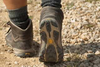
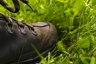
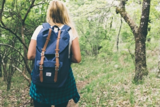
Activities and Nature
Search for interesting activities by type and / or area or with the help of keywords, end by pressing "Show results"
13 Search results, page 1/1
Clear filters-
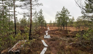
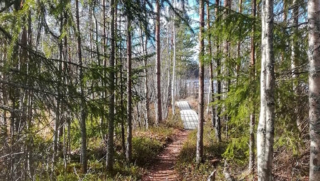
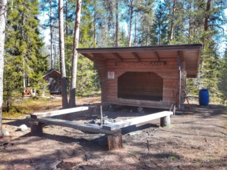
The initial part of the hiking trail on Fatisaari winds through varied terrain until vast bog landscapes unfold before your eyes. Thanks to over a kilometer-long boardwalk, you can admire the marsh landscapes with dry feet. Along this boardwalk, hikers can breathe in the scent of the marsh and take a break at the majestic rock on Fatisaari’s summit, where there is a lean-to shelter. Later, you get to enjoy the beautiful nature once again as you follow the same trail back to the starting point.
- Starting point: From Tulisalontie 525, turn onto Marjoniementie, continue until a narrow road turns right at Tuuralan hunting lodge. The trail is found at the end of this road. Park your car in a way that doesn’t obstruct other road users. Do not park in the hunting lodge yard!
- Length: Approx. 6 km round trip
- Difficulty: Easy
- Walking time: 1.5 to 2 hours
- Map at the web page
- GPX file available here.
https://isokyro.fi/vapaa-aika-ja-matkailu/liikunta/luontoreitit/patikkareitisto/
-
Disc golf Courses in the Vaasa Region
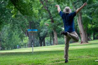
The Frisbee golf courses in the Vaasa region offer games in fantastic surroundings and varied terrain.
-
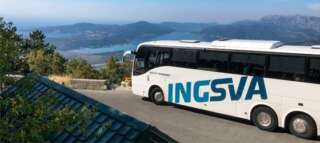
INGSVA
-
+358 6 470 1257, +358 50 314 2353
uimahalli.parske@isokyro.fi
-
Starting Point: The parking area is located at the end of Pohjantie.
Length: 1.4 km circular route (total length 2.3 km if taking the round-trip path to Isohaankallio).
Difficulty: Easy.
Walking Time: 30 min – 45 min.
You don’t need to go far to reach Lapinmäki. You can quickly embark on the hiking trail located right next to Isokyrö center. However, don’t let the proximity fool you; along the route, there are genuine nature experiences on an easily navigable trail. The starting point of the route is right next to the playground, making it an excellent destination for families with children.
https://isokyro.fi/vapaa-aika-ja-matkailu/liikunta/luontoreitit/patikkareitisto/
-
Lymmyysen nature trail is well-suited for families with children. The route offers various types of terrain, and along the way, there is information about different aspects of the area’s nature in the form of signs. It’s pleasant to conclude the excursion in a covered hut or log shelter while enjoying refreshments. The trail is located right next to Palhojaistentie, making it easily accessible.
- Starting point: From the point where Palhojaistentie 260 turns into a gravel road towards the parking area and the starting point of the trail.
- Length: 800m circular route
- Difficulty: Easy
- Walking time: 15 minutes to 30 minutes
- Map on the web page
- GPX-file available here.
https://isokyro.fi/vapaa-aika-ja-matkailu/liikunta/luontoreitit/patikkareitisto/
-
Start Point: Åbergintie 64.
Length: 11 km circular route.
Difficulty: Challenging.
Walking Time: 2.5-3 hours.
The Orisberg area has a diverse history, influenced by many key figures in Finnish history, from Zacharias Topelius to Jean Sibelius. The atmosphere around Orisberg Church is charming, and the starting point for the route is the bell tower, where, according to the tale, Sibelius and Aino Järnfelt got engaged. The route winds around Kotilampi through varied terrain on trails, duckboards, and forest roads. Those planning a shorter excursion can follow the hiking trail to Kotilampi cabin and return along the same path to the church. Those taking on the longer route continue from the cabin, circumnavigating the entirety of Kotilampi.
https://isokyro.fi/vapaa-aika-ja-matkailu/liikunta/luontoreitit/patikkareitisto/
-
Starting Point: The parking area is located next to Peippoos Disc Golf Course, along Peippoostentie just to the left shortly after the playground.
Length: Several circular routes ranging from 1 km to 3 km.
Difficulty: Easy.
Walking Time: Approximately 45 minutes for the 3 km route.
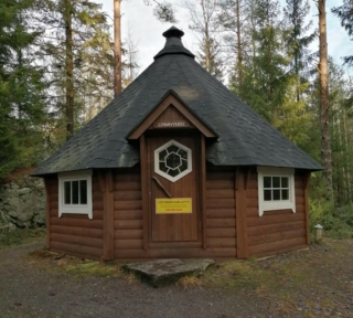
Adjacent to the parking lot is the gravel-covered Kylkkälä Fitness Trail, which is groomed in winter. Walking on the ski tracks is not allowed. There is also a disc golf course along with the fitness trail, so exercise caution regarding flying discs. The starting point of the nature trails is on the opposite side of Peippoostentie. The first 200 meters follow the pedestrian path uphill to the beginning of the trail, and the return point of the route is near the parking area. The nature trail is intended to be walked clockwise. The routes offer a true nature experience right in the vicinity of residential areas. The trail network is diverse, providing plenty of options for hikers. Along the nature trail, you’ll find a fireplace, and next to the fitness trail, there is also a lean-to shelter.
https://isokyro.fi/vapaa-aika-ja-matkailu/liikunta/luontoreitit/patikkareitisto/
-
The Rööki trail combines many different elements. At the starting point, there is a well-equipped beach at Ruusupuro, from where the trail goes through a majestic forest. The diverse natural elements in the area provide variation and challenges for the trail. Near the Rööki lean-to, bird boxes have been installed along the trail, so at the midpoint of the trail, you can sit by the fire and observe the life of birds up close.
- Starting point: Ruusupurontie 769.
- Length: 5 km circular route
- Difficulty: Challenging
- Walking time: 1.5 to 2 hours
- Map and GPX file can be found on the website.
https://isokyro.fi/vapaa-aika-ja-matkailu/liikunta/luontoreitit/patikkareitisto/
-

Our modern and stylish fleet consists of a total of 16 taxis, minibuses and charter bus. Our safe and environment friendly vehicles offer memorable trips whether you travel alone or in a group.
The vehicles offer solutions for any occasion. Our barrier-free vehicles offer elevators for disabled and also the possibility to transport customers on stretchers. Keep your refreshments in the fridge or enjoy warm coffee directly from the machine. Arrange a meeting in car, surf the web or enjoy a movie. We are here to fulfill even your smallest wishes!
+358 400 864 393
info@tapiolaeoy.com
-
Starting Point: Ventäläntie 670, parking only in the designated parking area, do not block the beginning of the trail with your car.
Length: 4 km circular route.
Difficulty: Moderate.
Walking Time: Approximately 1 hour.
The Tuomaanmäki area is a nature reserve that includes a Bronze Age burial mound. The mounds have been excavated, and stones have been removed. From one of them, apparently, all stones have been taken, leaving only a circular arrangement of stones locally referred to as “käräjäkivet” or judge’s circle. This is the origin of the place’s former name, Tuomarmäki. Tuomaanmäki is an environmentally and geographically splendid Bronze Age burial mound site with significant natural values. Along the route, hikers have the opportunity to explore ancient burial mounds, a “giant’s kettle” (which is not actually a giant’s kettle), diverse nature, and take a break at a campfire site. One of the stories from the mobile game “Tarinapolku” can be found here.
https://isokyro.fi/vapaa-aika-ja-matkailu/liikunta/luontoreitit/patikkareitisto/
-
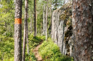
In Vuoressalo, the hiker can ascend from the fields to the top of the majestic white cliffs amidst nature. The cliffs conceal much to see and experience in their shadows. In Vuoressalo, there are many peculiar rock formations, the origins of which have been the subject of speculation over the years. On the current basic map of the area, for example, there is a location called “pakouuni,” a place that, according to legend, is a low, built wall that the farmers participating in the club wars of the 16th century constructed as protection. At the site, there is a natural crack in the rock that forms an approximately 2-meter-high vault. The area is marked by superstition, and these places have not been daringly investigated thoroughly by the locals.
- Starting point: Kuivilantie 174. Parking is available on the opposite side of the road from the starting point. Do not park on the road.
- Length: Two approximately 2 km circular routes
- Difficulty: Easy
- Walking time: 45 minutes to 1 hour
- Map and GPX file are available on the website.
https://isokyro.fi/vapaa-aika-ja-matkailu/liikunta/luontoreitit/patikkareitisto/
-
Starting Point: The trails can be accessed from two different points, either from the parking area of Ylipää Youth Association (Ylipään nuorisoseura) at Valtaalantie 403 or next to Lukkuhaan camping area at Kortesluomantie 157. Parking is only allowed in designated parking areas.
Length: Several circular routes ranging from 1-5 km.
Difficulty: Easy, with varying elevations.
Walking Time: Approximately 1 hour for a 5 km route.
Ylipää’s diverse trails offer something for everyone. The area features versatile fitness trails of different lengths and several campfire sites. In the middle of the route, near Marjamäki observation tower, it is possible to take a break with a larger group, as there are two campfire sites there. The trail network is centrally located and easily accessible. The proximity of the camping area makes the trail a suitable destination for visitors to the area, approaching the route through forested landscapes up to the top of Marjamäki.
https://isokyro.fi/vapaa-aika-ja-matkailu/liikunta/luontoreitit/patikkareitisto/