
Activities and Nature
Search for interesting activities by type and / or area or with the help of keywords, end by pressing "Show results"
17 Search results, page 1/1
Clear filters-
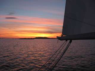
The name ”Solrutten” translates to The Sunny Route in English. The concept was originally formed in the 1970’s. The operators who developed The Gulf of Bothnia’s sea lane network at that time came up with the name. Today the Sunny Coast Route stretches through 13 municipalities and towns’ sea areas along the west coast of Finland, from Kristiinankapunki in the south to Kokkola in the north.
The routes and marinas are geographically featured according to in which municipality they are situated. As the municipalities and the regional council mediate a lot of information to travelers, we have on our part decided to create our own website based on the municipality division. In this way sailors can easily access information about the municipality they are passing through and thus making information search a lot easier.
The archipelago of Ostrobothnia is shallow and stony. This means that navigation in the region requires a great deal of skill and care. We have decided to create the information about routes and the information given about how to approach the marinas on a basis requested by those skippers who navigate with deeper boats.
On the web page solrutten.fi you find route suggestions and recommended destinations. On the map, you can click on a selected location for more information about the harbor and how to approach it.
-
-
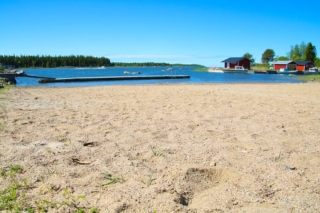
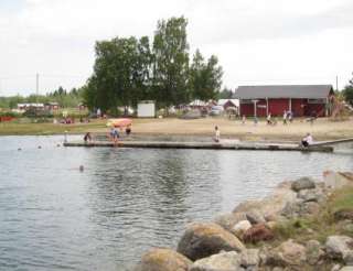
Changing rooms, diving tower, swings, and sandy beach.
There is also a kiosk 200 meters from the beach. -
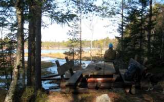
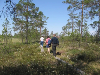
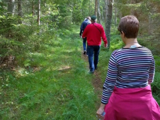
In Bergö, you will find a beautiful 8-kilometer-long hiking trail that takes you through the most scenic forest areas of Granö. Along the hiking trail, there are resting places, information boards, and artworks, as well as the grill hut Adolf, where you can take a break while grilling sausages or enjoying your packed lunch.
-
Disc golf Courses in the Vaasa Region
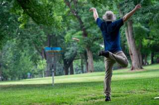
The Frisbee golf courses in the Vaasa region offer games in fantastic surroundings and varied terrain.
-
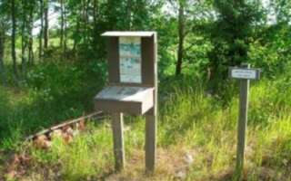
The rich pasture system in Malax can be experienced along this trail. Fifteen old chalet foundations have been marked along the beautiful path. At the beginning of the trail there is a board with a map and a box of brochures and along the path there are signs showing where the 15 cabins stood. The trail is about 1 km long.
-
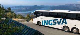
INGSVA
-
The trail can be walked on a 800 m route or a 1.8 kilometers route.
Well marked nature trail where you can acquaint yourself with cairns and cup stones from the Iron Age. The area was inhabited 200-700 A.D. Exuberant flora.
-
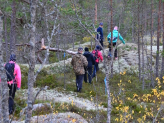
The hiking trail begins at the Kajane camping area located along the Kajane forest road, approximately 2.6 km from National Road 8. The Kajane camping area is situated next to a large bog near Lillträsket and Lisansjön. The Kajane hiking trail itself is 3 km long. The trail partly runs on boardwalks across the bog and extends to Lisansjön. Map indicating the hiking trail is marked (pdf).
Along the hiking trail, informational signs are placed, providing details about the area’s fauna and flora. The trail leads to Lillträsket (0.8 km) where a shelter is available. At the Kajane camping area, there is also a sauna, overnight cabin, and several barbecue shelters. A fee is charged for the use of the cabin and sauna.
The maintenance of the Kajane hiking trail is overseen by the Yrkesakademin in Österbotten.
For booking the area’s overnight cabin and more information.
-
Majors Nature Trail begins at Strandvägen 2118, 6 km south of Pappadagis Neste. There is a large parking area at the beginning of the trail. Along the path, you can walk 1.2 km, 2.2 km, or 3.4 km.
The trail is marked with blue ribbons and informational signs. The shorter trail (1.2 km) with more hilly areas has stairs. There is also a cozy rest area with log tables.
Map indicating the hiking trail is marked (pdf).
-
The trail starts from either Storsjön, Storsjövägen 617, or from Mamrelund, Mamrevägen 357. The trail is a total of 8 km long, or 4 km one way, either to Storsjön or Mamrelund.
The trail between Storsjön in Malax and Mamrelund in Petalax has long been a connecting route between the forest villages in Malax. The trail is marked with orange reflective poles and informational signs.
-
The nature trail starts fråm Klockarisvägen 14, close to the cross roads with Klockarisgränd.
The nature trail is divided into three parts, and you can walk different distances: 1.8 km, 3.1 km, 3.4 km, and 4.5 km.
-
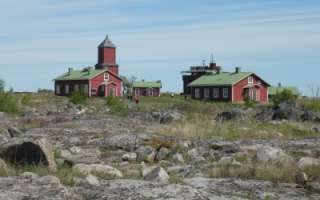
The services of the rental cottages on the island Fäliskäret are primarily aimed at the guided groups and boating people the Kvarken Archipelago. In the 18th century, a pilot station was established on Fäliskäret. The harbour is a popular excursion harbour. The services of the rental cottages on the island Fäliskäret are primarily aimed at the guided groups and boating people the Kvarken Archipelago.
http://solrutten.fi/en/harbours/malax/faliskar-(ronnskaren)/
-
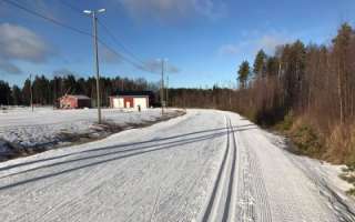
Skiing Tracks and Sports grounds in Malax
-
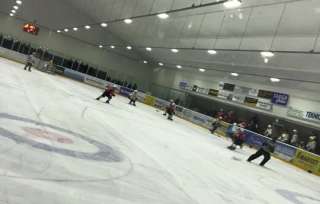
A modern and multi functional ice hall in Malax
bokning@malaxishall.fi
-
Westcoast Sportfishing
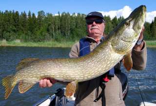
Experience a great fishing adventure in the Kvarken Archipelago with Westcoast Sportfishing and fishing guide Johan Nydahl. I guide You or Your company all year around with different rod fishing techniques after perch and pike.
To guide larger groups I co-operate with other fishing guides in the area. Arranging half and whole day fishing experience, excluding or including lunch, sauna and dinner depending on your requirements.
+358 50 5532360
info@westcoastsportfishing.fi
-
The hiking trail starts from Mobergsvägen 520 or Åminnevägen 251. There is no parking available at the start of Mobergsvägen, so it is recommended to park at the Kvarken Boat Museum, where there is also a bird observation tower and a barbecue area. From there, you can access the Åminne hiking trail along Åminnevägen and Mobergsvägen. Alternatively, you can park at Åminnevägen 251 (“Dimmornas bro”), where there is also a barbecue area.
The various stretches of the hiking trail are 2 km, 4.1 km, and 5.1 km, and the terrain is easy, suitable for all. Map indicating the hiking trail is marked (pdf).