
Activities and Nature
Search for interesting activities by type and / or area or with the help of keywords, end by pressing "Show results"
36 Search results, page 1/2
Clear filters-
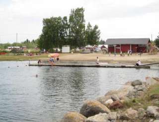
Archipelago Tours organizes nature guidance, excursions, wandering, fishing, sailing, courses, adventurous program services and camp schools mainly in the Finnish Kvarken Archipelago.
+358 500996927
saaristoretket@gmail.com
-
The name ”Solrutten” translates to The Sunny Route in English. The concept was originally formed in the 1970’s. The operators who developed The Gulf of Bothnia’s sea lane network at that time came up with the name. Today the Sunny Coast Route stretches through 13 municipalities and towns’ sea areas along the west coast of Finland, from Kristiinankapunki in the south to Kokkola in the north.
The routes and marinas are geographically featured according to in which municipality they are situated. As the municipalities and the regional council mediate a lot of information to travelers, we have on our part decided to create our own website based on the municipality division. In this way sailors can easily access information about the municipality they are passing through and thus making information search a lot easier.
The archipelago of Ostrobothnia is shallow and stony. This means that navigation in the region requires a great deal of skill and care. We have decided to create the information about routes and the information given about how to approach the marinas on a basis requested by those skippers who navigate with deeper boats.
On the web page solrutten.fi you find route suggestions and recommended destinations. On the map, you can click on a selected location for more information about the harbor and how to approach it.
-
-
-
-
-
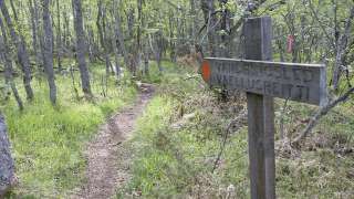
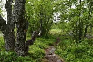
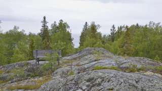
In Bergö, you will find a beautiful 8-kilometer-long hiking trail that takes you through the most scenic forest areas of Granö. Along the hiking trail, there are resting places, information boards, and artworks, as well as the grill hut Adolf, where you can take a break while grilling sausages or enjoying your packed lunch.
-
Björkö-Panike hiking trails
The archipelago section of the Björkö-Panike hiking trail
The archipelago section of the Björkö-Panike hiking trail is 8 km long and primarily traverses the island of Slåttskäret, right in the heart of the World Heritage site. Along the trail, one can experience the tranquility of the archipelago and witness the specialties of land uplift, such as moraine ridges and secluded sea inlets. During the summer, the island serves as traditional grazing land for sheep.
To access the route on Slåttskäret, one must arrange boat transport across the strait either from the Panike side or the Björköby side. In Björköby, the journey can begin either from Svedjehamn or from the Långgrundet rest area (the hike from Svedjehamn to Långgrundet is approximately 3.5 km).
The hiking trail is of moderate difficulty, and parts of the trail are rocky or damp.
Starting points:
1. Svedjehamn parking area: Björkövägen 1008, 65870 Björköby. The parking lot has a voluntary parking fee.
2. Vargis parking, Vargisvägen, 65970 Söderudden.The initial part of the trail
The initial part of the trail (Svedjehamn – Långgrundet – Svedjehamn) can be hiked without boat transport and partly as a loop. Depending on the chosen route, the hike can be approximately 7-10 km long. Further description of the trail.
Difficulty level: The trail is easy to hike, but there are stairs at two locations to cross sheep fences. The trail is partially rocky. The distance between Svedjehamn and the Märaryggen bridge’s observation platform (1 km/ direction) is a challenging accessible trail. No winter maintenance except on the path leading to the Saltkaret observation tower and a part of the parking lot.
Starting point: Svedjehamn parking area, Björkövägen 1008, 65870 Björköby. The parking lot has a voluntary parking fee.
Bodvattnet trail
Bodvattnet runt 4-km circle trail, with a demanding accessible section of 1 km or 1.4 km / each way
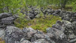
About 100 years ago, the old fishing port of Bodback set off on dangerous trips across the rocky Kvarken to Umeå. In addition to mail, government officials were also transported. Now only a small creek connects this port to the sea! Come and see how land uplift changes the Kvarken World Heritage landscape.
Difficulty: Demanding accessible.
Estimated travel time: During summertime the entire loop (4 km) on foot 1.5 hours, no winter maintenance.Travel time by wheelchair on one direction:
- The Svedjehamn parking area – Saltkaret observation tower – Märaryggbirdge 1 km, approximately 0.5 hours.
- The Svedjehamn parking area – Bodback old harbour 1.4 km, less than one hour.
The trail between Svedjehamn parking area and Saltkaret observation tower is snow-cleared during wintertime, including the parking area.
Map of Björkö-Panike hiking trails.
https://www.nationalparks.fi/description-of-trails#BjorkoPanikeHikingArchipelago
-
Bodvattnet runt 4 km circle trail, with a demanding accessible sections of 1 km and 1.4 km / each way
About 100 years ago, the old fishing port of Bodback set off on dangerous trips across the rocky Kvarken to Umeå. In addition to mail, government officials were also transported. Now only a small creek connects this port to the sea! Come and see how land uplift changes the Kvarken World Heritage landscape.
Difficulty: Demanding accessible.
Estimated travel time: During summertime the entire loop (4 km) on foot 1.5 hours, no winter maintenance.
Travel time by wheelchair on one direction:- The Svedjehamn parking area – Saltkaret observation tower – Märaryggbirdge 1 km, approximately 0.5 hours.
- The Svedjehamn parking area – Bodback old harbour 1.4 km, less than one hour.
The trail between Svedjehamn parking area and Saltkaret observation tower is snow-cleared during wintertime, including the parking area.
Starting point: The Svedjehamn fishing harbour parking area Address: Svedjehamn fishing harbour, 65870 Svedjehamn. The parking area does not have separate accessible parking spaces, but there is usually plenty of space. The parking area’s surface material is gravel. The parking area is flat.
https://www.nationalparks.fi/description-of-trails#BodvattnetruntTrail
-
Dare2Do focuses on organizing outdoor activities with a low threshold in the Kvarken region.
During the winter focus is on snowshoe hiking for smaller groups of maximum 10-12 people. High quality products support a good experience.
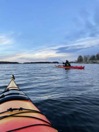
Hiking events with different lengths from spring to fall. During the summer, depending on the weather, generally mid-May to mid-September Dare2Do offers various forms of sea kayaking for groups of up to five people with high level of safety and optimized experience in mind. Safety/rescue events/training, beginner’s try out, Half-day-Full day tours or tours with overnight stay.
Survival skills and learning can be baked into the program with any activity.
Retreat type of events for all activities can be planned together for an optimized enjoyable time in nature.
+358 40 579 2874
info@dare2do.fi
-
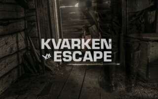
Kvarken's Sea Monster – Escape Game

Experience the Kvarken Archipelago World Heritage in a new way and play the escape game at the visitor centre World Heritage Gateway by the Replot bridge!
The sea monster was first sighted in the Kvarken Archipelago as early as the 1800s. Now it seems to have returned to our rocky kingdom. Step into the exhibition Weichsel and track the monster down!
Who can play?
Our escape game can be played by adults and children from age 7 upwards. School-aged children are recommended to play with an adult. The exhibition room is accessible, so the game is also suitable for people with reduced mobility with an assistant. The game can be played in English, Finnish, or Swedish.Game time: 45 minutes
Amount of players: 2-6 players+358 50 3466 200
info@kvarken.fi
-
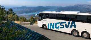
INGSVA
-
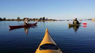
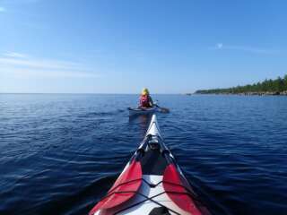
Vaasa Kayak Rental offers everyone access to the sea and the opportunity to paddle in, for example, the Vaasa archipelago or the Kvarken World Heritage Site.
Starting point is in the summer Rantakatu 21 in Vaasa where you can launch the kayak.
If you prefer to start from some other spot, you can transport the kayak. If you rent several kayaks, we can also rent a trailer with kayak carrying rack, the trailer fits up to 10 kayaks.
Booking alternatives:
- 3 hours
- whole day (9-18)
- weekend (Fri-Sun)
+358 40 505 5665
info@vaasankajakkivuokraus.fi
-
In Klobbskat there is a short nature trail which leads to Kikanberget (0,8 km). It starts at the coffee shop/restaurant in the harbour and leads along the shore to the top of Kikanberget.
Easy in the beginning, to climb up the Kikanberget hill is a bit more demanding.
To see
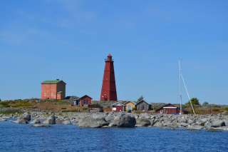
geology, vegetation and animals of the land uplift shores, an observation point on the rock, foundations of former fishing huts, boat docks and piles of stones in which net-drying poles used to stand in the past.From the observation tower you can spot the Kvarken’s beautiful natural heritage from a total height of 25 meters. With the naked eye, the lighthouses are distinguished at Norrskär, Utgrynnan and Valsörarna. In the spring and autumn, the observation tower is a good place for bird watching.
https://www.nationalparks.fi/description-of-trails#KikanbergetNatureTrail
-
KAJAK RENTAL
Kvarken4seasons offers kayak rentals on Västerö in Maxmo archipelago. Rent a kayak for a few hours, full day or longer. We are also mobile and can move the kayaks to the starting point you want in the Maxmo archipelago. Get in touch we tell you more.
+358 45 883 2209
kvarken4seasons@gmail.com
-
Life gets so much funnier with entertainment, laughter and adventures
KvarkenEscape offers challenges, entertainment and enjoyment for both adults and children. Our escape rooms in the Kvarken Archipelago are inspired from the life on our islands from the past and nowadays. But, perhaps with a little, okay with a bit more than little, spiced up interpretations.
Read more about the rooms on the home page!
+358 40 1968 441
info@kvarkenescape.fi
-
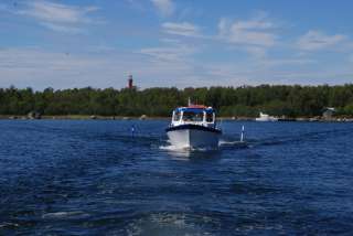
Kvarkenturer arranges boat trips amongst the small rocky islands of the Kvarken Archipelago.
We offer:
– boat trips adaptable to your own preferences
– prebooked trips to Valsörarna islandsWe also arrange:
– fishing trips
– transportation of goods / materialsOur boat trips are arranged in a cabin boat or in an open boat. Both boats are registered for 12 people.
+358 50 3553 924
fredric@kvarkenturer.fi
-
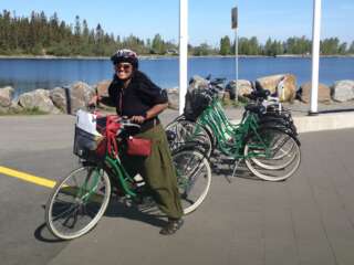
The idyllic archipelago villages and peaceful roads invite to cycle! Perhaps you follow the road from Vaasa all the way to the De Geer moraine scenery where the road ends and sea begins. Or perhaps you would like to rent a World Heritage bicycle and explore the World Heritage area.
The World Heritage bicycles can be rented from the following places in the archipelago:
- The World Heritage Gateway by the Replot bridge
- Cafe & Restaurant Salteriet or the inn Merenkurkun majatalo in the village of Björköby
- Sommaröhallen handicraft shop in the village of Södra Vallgrund
-
Mickelsörarna Nature Trail on Kummelskär Island is about 2 km long. On this nature trail, visitors are able to see the geology, vegetation and animals of the land uplift shores, foundations of old fishing huts and boat docks from the 16th century.
The trail starts from the yard of the Mickelsörarna Nature Station and is only available by boat.
https://www.nationalparks.fi/description-of-trails#MickelsorarnaHiking
-
Molpehällorna Nature Trail is about 2 km long and starts from the yard of the Molpe Nature station.
Along the nature trail you’ll see the geology, vegetation and animals of the land uplift shores as well as a reconstruction of the Molpehällorna “vippbåk” beacon (which is a memorial for the first beacon in the Gulf of Bothnia).
The trail is available only by boat.
https://www.nationalparks.fi/description-of-trails#MolpehallornaNatureTrail