
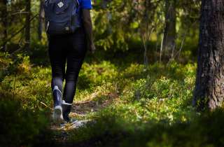
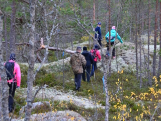
Activities and Nature
Search for interesting activities by type and / or area or with the help of keywords, end by pressing "Show results"
63 Search results, page 2/4
Clear filters-
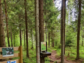
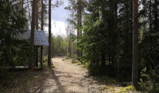
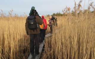
In Klobbskat there is a short nature trail which leads to Kikanberget (0,8 km). It starts at the coffee shop/restaurant in the harbour and leads along the shore to the top of Kikanberget.
Easy in the beginning, to climb up the Kikanberget hill is a bit more demanding.
To see
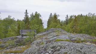
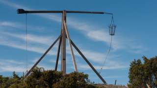
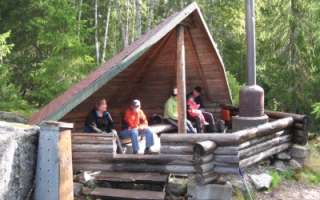
geology, vegetation and animals of the land uplift shores, an observation point on the rock, foundations of former fishing huts, boat docks and piles of stones in which net-drying poles used to stand in the past.From the observation tower you can spot the Kvarken’s beautiful natural heritage from a total height of 25 meters. With the naked eye, the lighthouses are distinguished at Norrskär, Utgrynnan and Valsörarna. In the spring and autumn, the observation tower is a good place for bird watching.
https://www.nationalparks.fi/description-of-trails#KikanbergetNatureTrail
-
Start from Kimo Bruk, Bruksgatan 38.
Parking is available up by the road. The trails are 1.5 km, 3 km, and 8 km.
Four rest areas with tables and benches are provided. The 1.5 km and 3 km trails are wide gravel paths suitable for strollers and, with assistance, wheelchairs, depending on the weather and season. The 8 km route includes partly uneven terrain.
Here you can find more information, a printable map, and an interactive map where you can explore the trail online.
Maps and a more detailed brochure are available for purchase at Kimo Bruk Museum and Gallery, as well as at Einar’s Café:
Conclude your hike with a leisurely stroll through the beautiful industrial park and take a lap around the “virgin dance” or stone labyrinth at the bruk (ironworks).
https://www.vora.fi/tjanster/motion-och-idrott/vandringsleder/
-
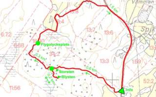
Kuni hiking trail consists of two routes: the north trail (6,4 km) and the south trail (7,9 km). The total lenght of the trail is 12,5 km and it starts at Kunintie 100 (next to the information board).
https://korsholm.fi/valfard/fritidsverksamhet/naturstigar-och-friluftsleder/kunileden
-
Starting Point: The parking area is located at the end of Pohjantie.
Length: 1.4 km circular route (total length 2.3 km if taking the round-trip path to Isohaankallio).
Difficulty: Easy.
Walking Time: 30 min – 45 min.
You don’t need to go far to reach Lapinmäki. You can quickly embark on the hiking trail located right next to Isokyrö center. However, don’t let the proximity fool you; along the route, there are genuine nature experiences on an easily navigable trail. The starting point of the route is right next to the playground, making it an excellent destination for families with children.
https://isokyro.fi/vapaa-aika-ja-matkailu/liikunta/luontoreitit/patikkareitisto/
-
Signs from Lotlaxvägen, Vörå. Längd: 3, 5 km.
Halvvägs finns en rastplats med bordsgrupper.The hiking trail of about 3.5 kilometers was laid out in the late 1980s by Lars Hannus and restored by the local community association in the summer of 2014. About halfway there is a rest area with table groups where you can pause and enjoy the tranquility.
https://www.vora.fi/tjanster/motion-och-idrott/vandringsleder/
-
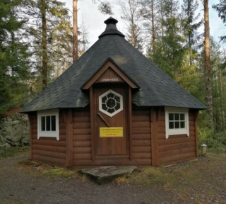
Lymmyysen nature trail is well-suited for families with children. The route offers various types of terrain, and along the way, there is information about different aspects of the area’s nature in the form of signs. It’s pleasant to conclude the excursion in a covered hut or log shelter while enjoying refreshments. The trail is located right next to Palhojaistentie, making it easily accessible.
- Starting point: From the point where Palhojaistentie 260 turns into a gravel road towards the parking area and the starting point of the trail.
- Length: 800m circular route
- Difficulty: Easy
- Walking time: 15 minutes to 30 minutes
- Map on the web page
- GPX-file available here.
https://isokyro.fi/vapaa-aika-ja-matkailu/liikunta/luontoreitit/patikkareitisto/
-
Majors Nature Trail begins at Strandvägen 2118, 6 km south of Pappadagis Neste. There is a large parking area at the beginning of the trail. Along the path, you can walk 1.2 km, 2.2 km, or 3.4 km.
The trail is marked with blue ribbons and informational signs. The shorter trail (1.2 km) with more hilly areas has stairs. There is also a cozy rest area with log tables.
Map indicating the hiking trail is marked (pdf).
-
The trail starts from either Storsjön, Storsjövägen 617, or from Mamrelund, Mamrevägen 357. The trail is a total of 8 km long, or 4 km one way, either to Storsjön or Mamrelund.
The trail between Storsjön in Malax and Mamrelund in Petalax has long been a connecting route between the forest villages in Malax. The trail is marked with orange reflective poles and informational signs.
-
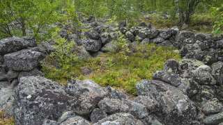
Mickelsörarna Nature Trail on Kummelskär Island is about 2 km long. On this nature trail, visitors are able to see the geology, vegetation and animals of the land uplift shores, foundations of old fishing huts and boat docks from the 16th century.
The trail starts from the yard of the Mickelsörarna Nature Station and is only available by boat.
https://www.nationalparks.fi/description-of-trails#MickelsorarnaHiking
-
Molpehällorna Nature Trail is about 2 km long and starts from the yard of the Molpe Nature station.
Along the nature trail you’ll see the geology, vegetation and animals of the land uplift shores as well as a reconstruction of the Molpehällorna “vippbåk” beacon (which is a memorial for the first beacon in the Gulf of Bothnia).
The trail is available only by boat.
https://www.nationalparks.fi/description-of-trails#MolpehallornaNatureTrail
-
A 2,6 kilometres long nature trail in Kuni, Korsholm.
https://korsholm.fi/valfard/fritidsverksamhet/naturstigar-och-friluftsleder/malsorleden
-
Start Point: Åbergintie 64.
Length: 11 km circular route.
Difficulty: Challenging.
Walking Time: 2.5-3 hours.
The Orisberg area has a diverse history, influenced by many key figures in Finnish history, from Zacharias Topelius to Jean Sibelius. The atmosphere around Orisberg Church is charming, and the starting point for the route is the bell tower, where, according to the tale, Sibelius and Aino Järnfelt got engaged. The route winds around Kotilampi through varied terrain on trails, duckboards, and forest roads. Those planning a shorter excursion can follow the hiking trail to Kotilampi cabin and return along the same path to the church. Those taking on the longer route continue from the cabin, circumnavigating the entirety of Kotilampi.
https://isokyro.fi/vapaa-aika-ja-matkailu/liikunta/luontoreitit/patikkareitisto/
-
Starting Point: The parking area is located next to Peippoos Disc Golf Course, along Peippoostentie just to the left shortly after the playground.
Length: Several circular routes ranging from 1 km to 3 km.
Difficulty: Easy.
Walking Time: Approximately 45 minutes for the 3 km route.
Adjacent to the parking lot is the gravel-covered Kylkkälä Fitness Trail, which is groomed in winter. Walking on the ski tracks is not allowed. There is also a disc golf course along with the fitness trail, so exercise caution regarding flying discs. The starting point of the nature trails is on the opposite side of Peippoostentie. The first 200 meters follow the pedestrian path uphill to the beginning of the trail, and the return point of the route is near the parking area. The nature trail is intended to be walked clockwise. The routes offer a true nature experience right in the vicinity of residential areas. The trail network is diverse, providing plenty of options for hikers. Along the nature trail, you’ll find a fireplace, and next to the fitness trail, there is also a lean-to shelter.
https://isokyro.fi/vapaa-aika-ja-matkailu/liikunta/luontoreitit/patikkareitisto/
-

Variable and beautiful nature, swamp, old forest and the mythical Björnberget, paths partly made by people and animals under a period of 100 – 200 years and a ribbon of small lakes and rest areas – that`s how to describe Petsmo Vandringsled.
You can walk a distance from 0,6 km up to 12,5 km, depending how you choose your route. The walking trail has two start places and if you choose to walk the whole trail you get to experience all four campfire places, all of them unique in their own way, but all with fantastic views.
Read more about the walking trail here
info@petsmovandringsled.fi
-
The Pilvilampi recreational area is located approximately nine kilometers east of the city centre. It makes up a proportion of an elongated ridge, of which includes Höstvesi and continues north of Vaasa. The recreational area itself covers an area of roughly 800 hectares. In the winter, the area is ridden with marked cross-country ski trails, which in summer are transformed into bicycle and hiking paths.
Download brochure for the nature path at Pilvilampi here.
https://www.vaasa.fi/en/living/freetime/naturevaasa/attractions/natural-environments/pilvilampi/
-
The nature trail starts fråm Klockarisvägen 14, close to the cross roads with Klockarisgränd.
The nature trail is divided into three parts, and you can walk different distances: 1.8 km, 3.1 km, 3.4 km, and 4.5 km.
-
Raineåsen’s nature trail to Storstenrösback ancient graves is about 1.5 km round trip. Start from parking area close to the hunting lodge at Raineås forest road in Pörtom, coordinates ETRS-TM35FIN N: 6969807 E: 220857
-
In the area, there are hiking trails and lean-tos, as well as an approximately 8-meter high observation tower with stunning views. Firewood is delivered to the lean-tos a few times a year. During the winter, there are also unlit ski trails in the area. The Rajavuori hiking trail is approximately 5.5 km long, forming a circular route. The trail starts from the wilderness and hiking center.
From Rajavuori, there is a connection to Levälampi, a recreational area maintained by Metsähallitus on the border of Kurikka and Laihia. Levälampi is also connected to Jurva’s Pässilä and further to Kalajaisjärvi in Ilmajoki. The route is known as the “Kurjenkierros,” and the journey from Rajavuori to Kalajaisjärvi covers a distance of 30 km.”
https://laihia.fi/hyvinvointi-ja-vapaa-aika/liikunta/liikuntatilat-ja-alueet/ulkoliikuntapaikat/
-
Risnästräskstigen in Övermark, 0.9 km to the barbecue hut at Risnästräsket and 2.1 km around the swamp.
Start from the parking spot at Heide forest road, coordinates ETRS-TM35FIN N: 6963477 E: 214123
-
Risö ja Ryövärinkari 4.9 kilometres
The Eteläinen Kaupunginselkä bay (the Southern City Bay) is located southeast of Vaasa city centre. There’s a nature trail and two bird towers in the area. Follow the signs ´Lintutorni` from the crossroad of the streets: Kanavasillantie/Hevossaarentie. Parking area at the end of road Ampujantie.
Coordinates: Euref-Fin (~ WGS84) lat: 63° 03.7663′ lon: 21° 41.9537’ETRS-TM35FIN N: 7003634 E: 232305
https://www.nationalparks.fi/kvarken/descriptionoftrails#RisoNatureTrail