
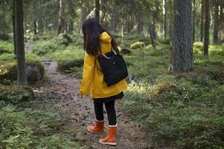
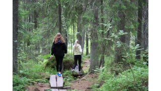
Activities and Nature
Search for interesting activities by type and / or area or with the help of keywords, end by pressing "Show results"
59 Search results, page 3/3
Clear filters-
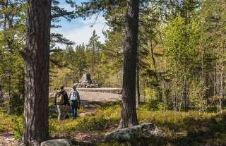
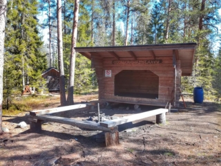
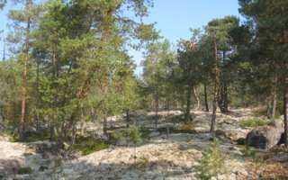
The Sommarö Nature Trails are located in the area of the former Sommarö fort, in Södra Vallgrund. The trail network consists of two circle trails and a back-and-forth trail that branches off, leading to the Södra Vallgrund Beach in Sommarösund past the giant’s kettle and cultural landscapes. In addition to the marine landscapes, you can spot signs of the Finnish Defence Forces’ activities.
The longer trail leads to the Sommarösund beach in Södra Vallgrund (7 km). The shorter circular trail is 1.5 kilometres long, and the section that goes around the Hålören peninsula is one kilometre long. There are two campfire sites and dry toilets, tables and benches, and an accessible viewpoint along the paths. In the yard of the Sommarö guardhouse there is a lean-to shelter (in public use). An information board (including maps) at each end of the trail and information boards along the trail.
https://www.luontoon.fi/en/trails/sommaro-nature-trail-korsholm-61409-en
-
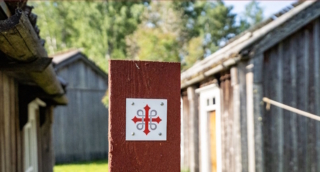
A European pilgrimage route through coastal Ostrobothnia. Connects up with the Norwegian-Swedish route St. Olavsleden, which leads to Trondheim. A total of 500 km long when complete.
-
Hiking Trails 6,6 kilometers (2 km) through the culture surroundings of Solf and Stundars in the municipality of Korsholm.
https://korsholm.fi/valfard/fritidsverksamhet/naturstigar-och-friluftsleder/stundars-vandringsleder
-
Welcome to a walk from the Öjbergsmossen bog to a giant’s pot hole and over a devil’s field to the dwarfed pinetree-covered meteorite-crater rim of Söderfjärden
Öjberget is located in Sundom, at a 9 km distance from the centre of Vaasa. The trail is 2,5 km long and the starting point is beside a big information board in Öjberget´s stadium area.
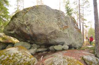
Öjberget is a unique ”mountain landscape” for the Ostrobothnian coast, with its highest point at an elevation of 50 metres. It is a magically rocky landscape with very old dwarfed pine trees, dramatic rocky formations, a giant’s kettle, and an ancient shore area called the Devil’s Field
The most ancient traces of human activity in the area of Vaasa are also found here. The findings originate from the Stone Age about 4,000 years ago.
In the outlook tower(+65 m a.s.l.) on the top of the slalom hill there are info boards about what you see in different directions: the meteorite impact crater Söderfjärden, the Kvarken archipelago, the village of Sundom and the centre of Vaasa.
-
Starting Point: Ventäläntie 670, parking only in the designated parking area, do not block the beginning of the trail with your car.
Length: 4 km circular route.
Difficulty: Moderate.
Walking Time: Approximately 1 hour.
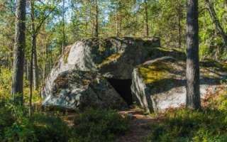
The Tuomaanmäki area is a nature reserve that includes a Bronze Age burial mound. The mounds have been excavated, and stones have been removed. From one of them, apparently, all stones have been taken, leaving only a circular arrangement of stones locally referred to as “käräjäkivet” or judge’s circle. This is the origin of the place’s former name, Tuomarmäki. Tuomaanmäki is an environmentally and geographically splendid Bronze Age burial mound site with significant natural values. Along the route, hikers have the opportunity to explore ancient burial mounds, a “giant’s kettle” (which is not actually a giant’s kettle), diverse nature, and take a break at a campfire site. One of the stories from the mobile game “Tarinapolku” can be found here.
-
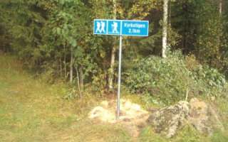
The trail leading to the campfire site at Västernäset is 2.1 kilometers. If you don’t want to walk the same route back you can walk the road through Vikby back to the starting point (3.6 kilometers). The trail is marked with blue/red.
https://korsholm.fi/valfard/fritidsverksamhet/naturstigar-och-friluftsleder/kyrkstigen
-

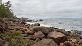
Valsörarna Nature Trail is a 3 km long nature trail from the pier of Ebbskär in the north to the pier of Storskäret in the south. Attractions along the thematic trail on the Valsörarna Islands include a lighthouse and lighthouse keepers’ buildings, fishing huts, ribbed moraine clusters, i.e., Rogen-type moraines and fladas, and a memorial for Russian soldiers. A biological station maintained by Ostrobothnia australis rf, established in 1966 mainly for bird observation and research, is also located on the Valsörarna Islands.
Valsörarna is an island group located outer in the Kvarken, about 15 km Northwest from Björkö. Already in the 1948 Valsörarna has been a birdprotection area.
The nature trail is available only by boat.
https://www.luontoon.fi/en/trails/valsorarna-nature-trail-korsholm-70006-en
-
Velkmossa hiking trail starts on the other side of the road from Velkmoss byagård, Ribackvägen 94 or from Viitala in Petalax. The trail is 9 km long round trip.
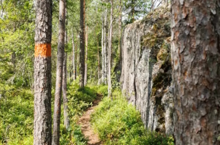
The trail is marked with yellow ribbons and yellow paint on trees, along with informational signs. Along the hiking trail, you’ll encounter Nojärv Swamp, where a bird observation tower is located. Nojärv Swamp is a marshy and overgrown wilderness lake, providing a favorable nesting environment for many bird species. Along the hiking trail, there is also a path leading to Kackur Bog as well as ancient graves and old settlements.
Coordinates ETRS-TM35FIN N: 6971020 E: 215932: 215932
-
Hiking route from Vikarskat fishing harbour to Finnhamn and back – 5 kilometers in total.
https://korsholm.fi/valfard/fritidsverksamhet/naturstigar-och-friluftsleder/vikarskat
-
Visit Vitmossen’s beautiful forest nature with reconstructed stone and Bronze Age houses. Hike the Bronze Age Trail to the unique settlement with burial cairns. This is one of the oldest settlements found in Finland and dates back to the Early Bronze Age.
Routs 3 km and 5 km.
Signs from Kuckusvägen 1148, Vöråhttps://www.vora.fi/tjanster/motion-och-idrott/vandringsleder/
-
In Vuoressalo, the hiker can ascend from the fields to the top of the majestic white cliffs amidst nature. The cliffs conceal much to see and experience in their shadows. In Vuoressalo, there are many peculiar rock formations, the origins of which have been the subject of speculation over the years. On the current basic map of the area, for example, there is a location called “pakouuni,” a place that, according to legend, is a low, built wall that the farmers participating in the club wars of the 16th century constructed as protection. At the site, there is a natural crack in the rock that forms an approximately 2-meter-high vault. The area is marked by superstition, and these places have not been daringly investigated thoroughly by the locals.
- Starting point: Kuivilantie 174. Parking is available on the opposite side of the road from the starting point. Do not park on the road.
- Length: Two approximately 2 km circular routes
- Difficulty: Easy
- Walking time: 45 minutes to 1 hour
- Map and GPX file are available on the website.
-
Västerö Hiking Trails are situated in the outer archipelago of the municipality of Vörå and can be reached by car. The trail starts from the parking areas on Söderskatavägen and Equityvägen, and the visitor can choose trails from 3 km up to 12 km. A map for the area is found in the parking area. There are also maps along the trail.
Along the trails there are a memorial for the Equity (a ship that carried weapons during the civil war in Finland), the cliffs of Ryssberget, the old land uplift forests, bays, flads and seashores. In the distance, you can see the Mickelsörarna archipelago.
There are campfire sites and resting spots, dry toilets, two huts to be used as rest spots (they are not meant for overnight stays). NOTE! No wood supply.
https://www.luontoon.fi/en/trails/vastero-hiking-trail-voyri-63614-en
-
The Waterloo trail starts at the Waterloo jogging track which is located along Strandvägen between Korsnäs and Molpe (Strandvägen 3681).
The trail runs between the Waterloo area and Lisasgrynnan by the sea shore. Beautiful hiking trail with many different terrain types to hike through. A geocache is also located at one of the rest areas.
The trail is about 7.3 km (3.66 km in one direction).In the same area you will also find a Disc Golf Park, fitness stairs and a playing area for boules.
https://www.korsnas.fi/bibliotek-kultur-fritid/vandringsleder/
-
Starting Point: The trails can be accessed from two different points, either from the parking area of Ylipää Youth Association (Ylipään nuorisoseura) at Valtaalantie 403 or next to Lukkuhaan camping area at Kortesluomantie 157. Parking is only allowed in designated parking areas.
Length: Several circular routes ranging from 1-5 km.
Difficulty: Easy, with varying elevations.
Walking Time: Approximately 1 hour for a 5 km route.
Ylipää’s diverse trails offer something for everyone. The area features versatile fitness trails of different lengths and several campfire sites. In the middle of the route, near Marjamäki observation tower, it is possible to take a break with a larger group, as there are two campfire sites there. The trail network is centrally located and easily accessible. The proximity of the camping area makes the trail a suitable destination for visitors to the area, approaching the route through forested landscapes up to the top of Marjamäki.
-
The hiking trail starts from Mobergsvägen 520 or Åminnevägen 251. There is no parking available at the start of Mobergsvägen, so it is recommended to park at the Kvarken Boat Museum, where there is also a bird observation tower and a barbecue area. From there, you can access the Åminne hiking trail along Åminnevägen and Mobergsvägen. Alternatively, you can park at Åminnevägen 251 (“Dimmornas bro”), where there is also a barbecue area.
The various stretches of the hiking trail are 2 km, 4.1 km, and 5.1 km, and the terrain is easy, suitable for all. Map indicating the hiking trail is marked (pdf).
-
Öjen’s nature trail, situated at the south side of Vaasa, is 4,5 km long. There are information signs along the trail that tell you about the area’s nature, medicinal plants and folk tales. There are also maps showing your location. The trail is easy to walk on because the terrain is fairly flat. However, please remember that the duckboards can be very slippery depending on the weather conditions. It takes about 2,5 to 3 hours to go around the trail.
Facilities: at the campfire site, there are benches, firewood, an axe and a dry toilet.
The nature trail is reached from the parking area along Myrgrundintie road (road number 6741). Walk along the smaller Öjenvägen road about 300 metres until you see a small bridge and information sign on your left side.
https://www.luontoon.fi/en/trails/ojen-nature-trail-vaasa-34912-en
-
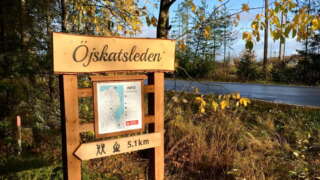
Length: The trail is 5.1 kilometres one way (10.2 km round trip).
Marking: The trail is market with blue dots and arrows in nature.Start: The trail starts from the north end of the village at Tåning (63.2454251, 21.9258751).
Parking is available at the community’s marina at Kalkmagasinet (63.2449409, 21.9296705).Directions: When you arrive, drive along Österhankmovägen and turn right at Österhankmovägen 900, where there are signs for parking and a memorial. Drive 100 meters forward, all the way down to the harbor and park the car there. Walk back to Österhankmovägen and walk another 100 meters along the road you drove. The trail starts on the left side and there is a map and instructions at the starting point.
Service along the trail: rest area with wind protection and at the end of the trail there is a barbecue area with benches.
https://korsholm.fi/valfard/fritidsverksamhet/naturstigar-och-friluftsleder/ojskatsleden
-
Vaasa’s Outdoor Recreation Trails on the Map
The nature trails in Vaasa have been combined into a cohesive network of about 70 kilometers, which was inaugurated in September 2025.
The work to unify the nature trails in Vaasa began in 2022, and over the course of three years the trails have been improved, standardized signs have been installed in the terrain, and a modern digital map of the network has been created.
The network’s trails run across land owned by the city in various districts. Along the trails there are campfire sites, beaches, playgrounds, outdoor exercise areas, and other places to experience. The trails are marked with signposts and information boards as well as on a digital map.
-
Desitnations and trails in the service Luontoon
You can find information on all outdoor recreation destinations, trails and services throughout Finland on the Luontoon service.