
Activities and Nature
Search for interesting activities by type and / or area or with the help of keywords, end by pressing "Show results"
63 Search results, page 4/4
Clear filters-
The hiking trail starts from Mobergsvägen 520 or Åminnevägen 251. There is no parking available at the start of Mobergsvägen, so it is recommended to park at the Kvarken Boat Museum, where there is also a bird observation tower and a barbecue area. From there, you can access the Åminne hiking trail along Åminnevägen and Mobergsvägen. Alternatively, you can park at Åminnevägen 251 (“Dimmornas bro”), where there is also a barbecue area.
The various stretches of the hiking trail are 2 km, 4.1 km, and 5.1 km, and the terrain is easy, suitable for all. Map indicating the hiking trail is marked (pdf).
-
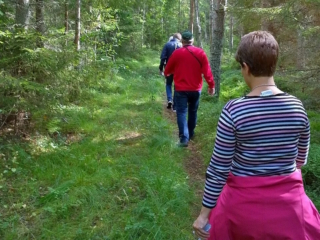
Öjen’s nature trail, situated at the south side of Vaasa, is 4,5 km long. There are information signs along the trail that tell you about the area’s nature, medicinal plants and folk tales. There are also maps showing your location. The trail is easy to walk on because the terrain is fairly flat. However, please remember that the duckboards can be very slippery depending on the weather conditions. It takes about 2,5 to 3 hours to go around the trail.
Facilities: at the campfire site, there are benches, firewood, an axe and a dry toilet.
The nature trail is reached from the parking area along Myrgrundintie road (road number 6741). Walk along the smaller Öjenvägen road about 300 metres until you see a small bridge and information sign on your left side.
-
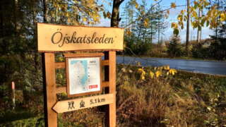
Length: The trail is 5.1 kilometres one way (10.2 km round trip).
Marking: The trail is market with blue dots and arrows in nature.Start: The trail starts from the north end of the village at Tåning (63.2454251, 21.9258751).
Parking is available at the community’s marina at Kalkmagasinet (63.2449409, 21.9296705).Directions: When you arrive, drive along Österhankmovägen and turn right at Österhankmovägen 900, where there are signs for parking and a memorial. Drive 100 meters forward, all the way down to the harbor and park the car there. Walk back to Österhankmovägen and walk another 100 meters along the road you drove. The trail starts on the left side and there is a map and instructions at the starting point.
Service along the trail: rest area with wind protection and at the end of the trail there is a barbecue area with benches.
https://korsholm.fi/valfard/fritidsverksamhet/naturstigar-och-friluftsleder/ojskatsleden