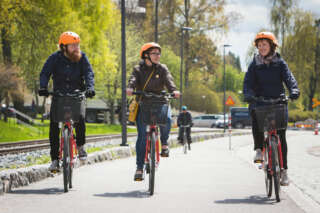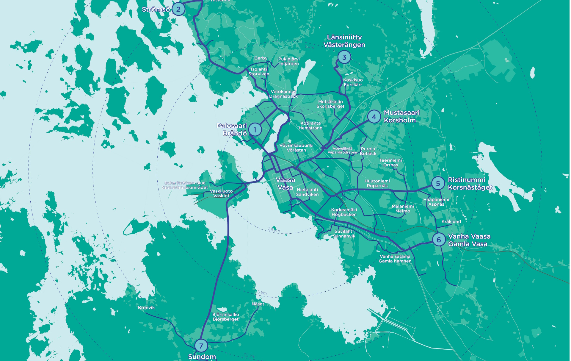
Marked Cycling Routes in Vaasa
Below are presented Vaasa’s 7 main cycling routes. The routes follow bike paths, and there are signboards with route information along the routes.
We have also marked the routes on Google Maps so that you can easily see the services available along the route. Please note that on Google Maps, the route may sometimes differ slightly from the marked route, as the cycling path may be so new that it is not yet included on any map. By following the route information along the path, you will find the correct route.
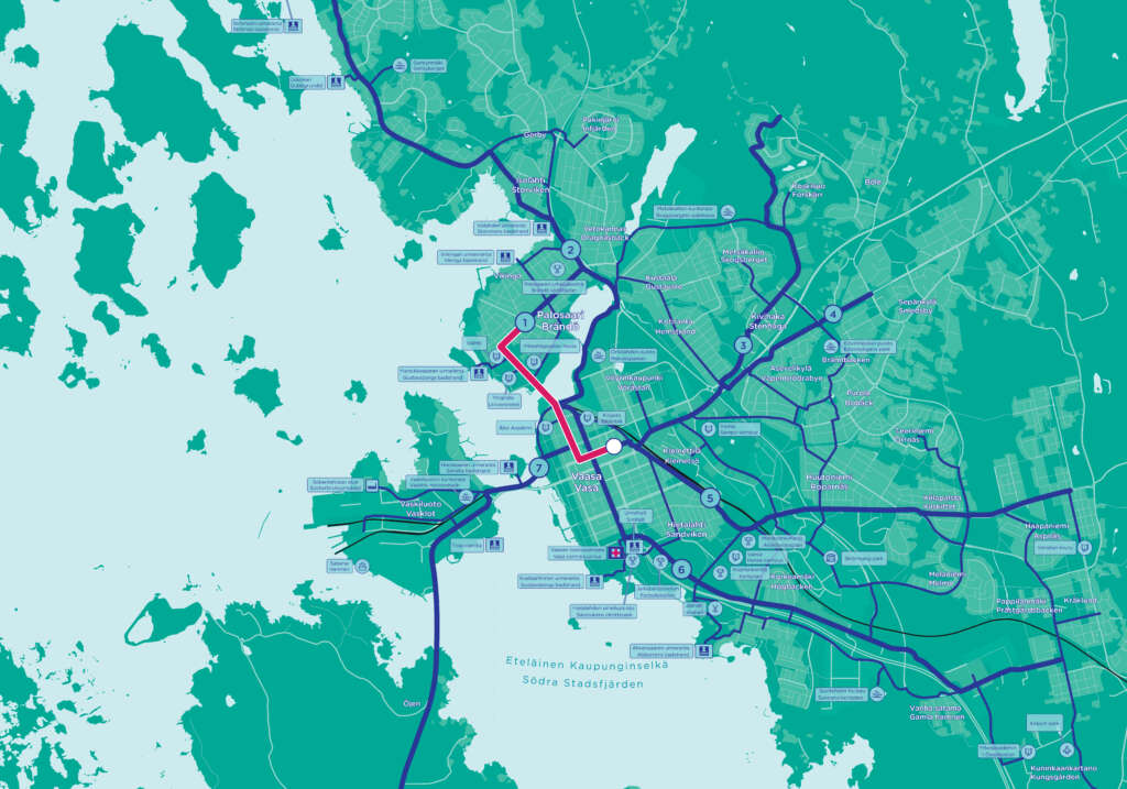
1. Vaasa city centre – Palosaari 2,1 km
Vaasa market square – Hovioikeudenpuistikko – Kirkkopuistikko – Wolffintie – Palosaarentie – Palosaaren tori.
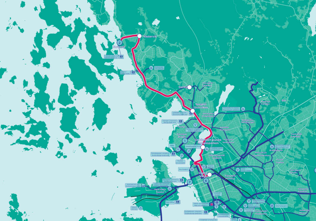
2. Vaasa city centre – Strömsö (Västervik) 10,1 km
Vaasa market square – Hovioikeudenpuistikko – Raastuvankatu – Järvikatu – Onkilahden toimintapuisto – Alskatintie – Huvilatie – Gerbyn rantatie – Västervikintie – Strömsöntie.
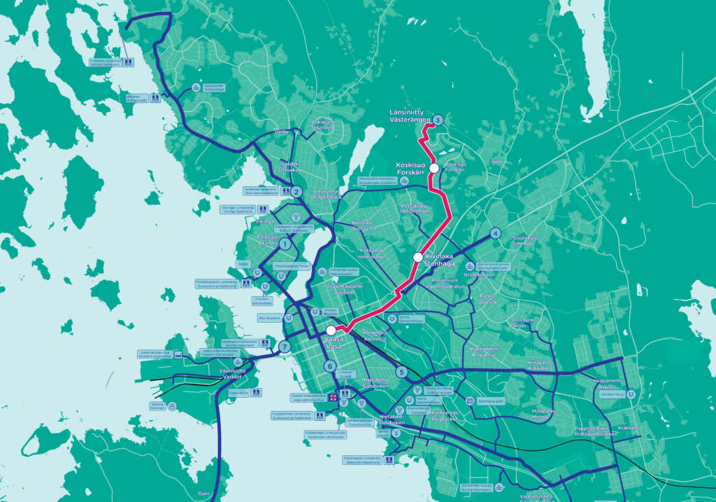
3. Vaasa city centre – Länsiniitty 6 km
Vaasa market square – Hovioikeudenpuistikko – Sepänkyläntie – Kivihaantie – Pohjolankatu – uusi pyörätie Pohjolankadusta Nuotiopiiriin (Google Mapsissa: Uusi Bölentie – Kaskimaantie) – Länsiniityntie.
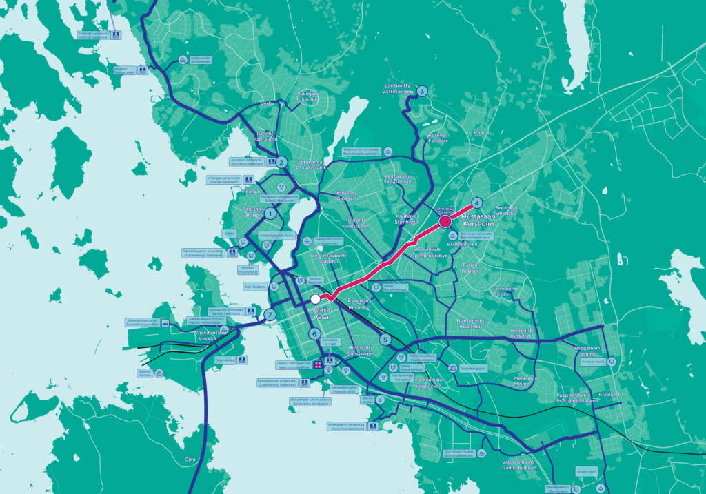
4. Vaasa city centre – Sepänkylä, Mustasaari 3,9 km
Vaasa market square – Hovioikeudenpuistikko – Sepänkyläntie – Kokkolantie – Viertolantie – Mustasaarentie – Keskustie.
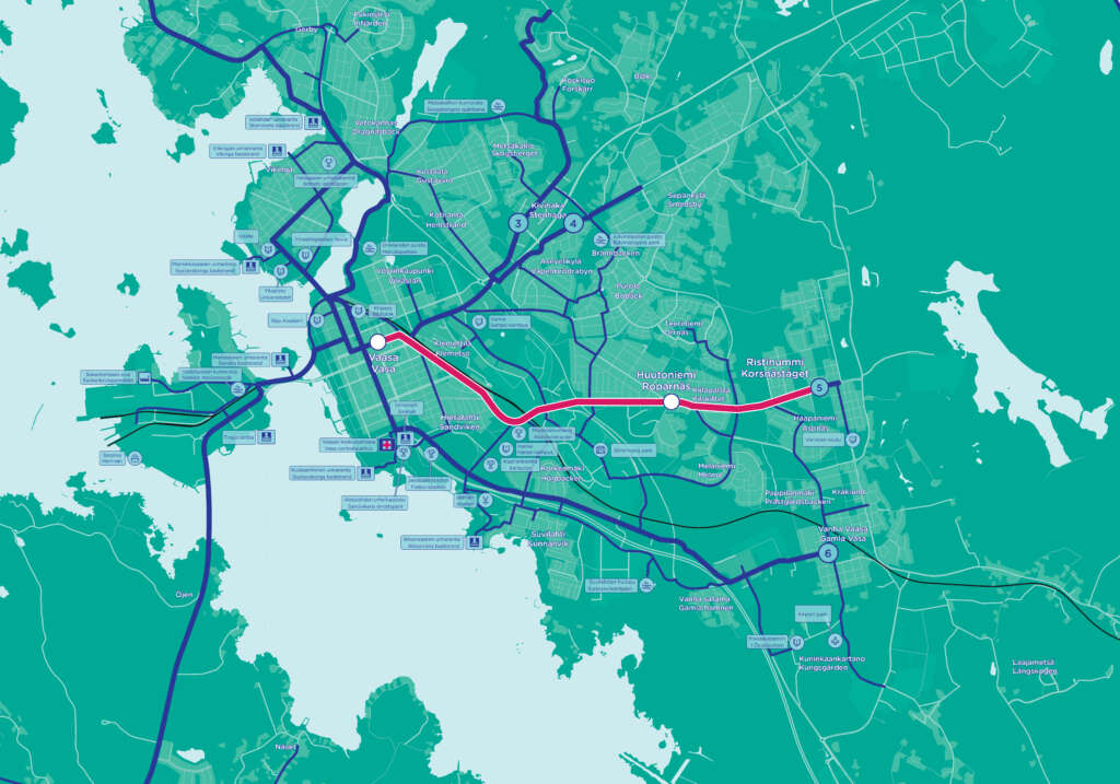
5. Vaasa city centre – Ristinummi 6,4 km
Vaasa market square – Hovioikeudenpuistikko – Ratakatu – Huutoniementie – pyörätie välillä Kunikaantie – Välitie (Google Maps Kunikaantie) – Kappelinmäentie – Vanhan Vaasan katu.
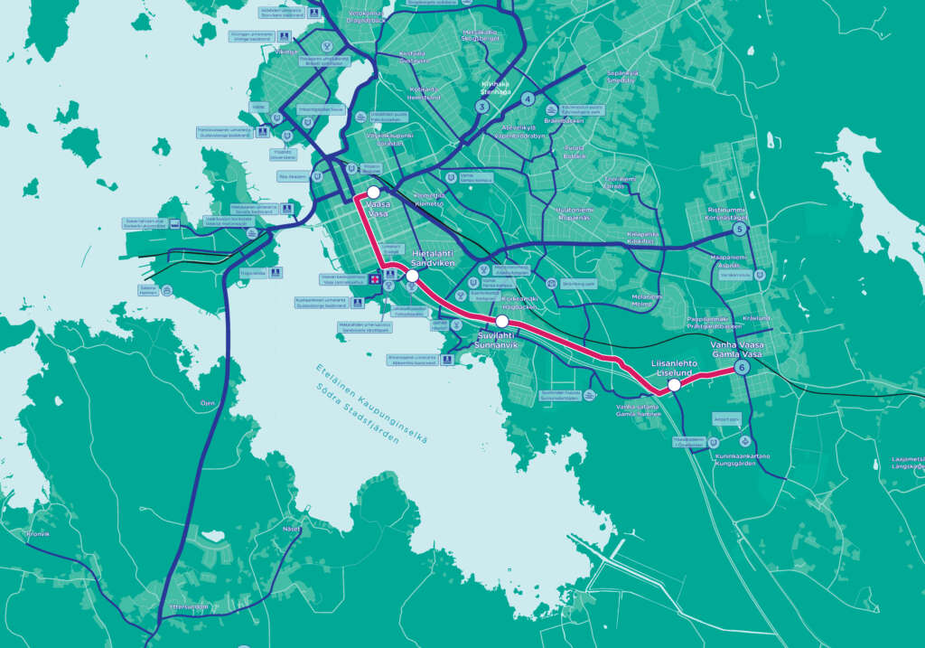
6. Vaasa city centre – Vanha Vaasa 7 km
Vaasa market square – Hovioikeudenpuistikko – Raastuvankatu – Hietalahdenkatu – Rantamaantie – Kanavasillantie – Torikatu – Kauppiaankatu.
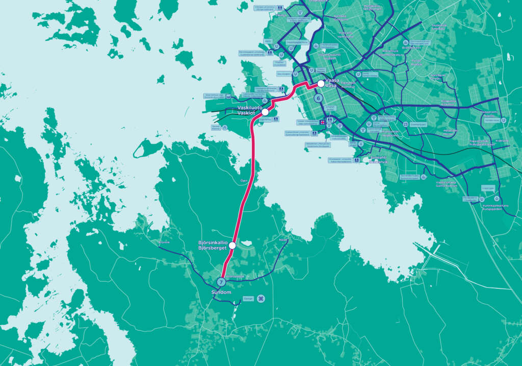
7. Vaasa city centre – Sundom 7,8 km
Vaasa market square – Hovioikeudenpuistikko – Kirkkopuistikko – Hietasaarenkatu – pyörätie Hovioikeudenaltaan ja Hietasaaren ohi – Mottorikatu – Myrgrundintie – Sundomin koulu.
You might also be interested in
-
Cycling in Vaasa and the Vaasa Region