
Activities and Nature
Search for interesting activities by type and / or area or with the help of keywords, end by pressing "Show results"
11 Search results, page 1/1
Clear filters-
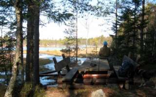
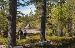
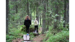
In Bergö, you will find a beautiful hiking trail that takes you through the most scenic forest areas of Granö. Along the hiking trail, there are resting places, information boards, and artworks, as well as the grill hut Adolf, where you can take a break while grilling sausages or enjoying your packed lunch.
You can choose to walk 3.5 km or 8 km.
-
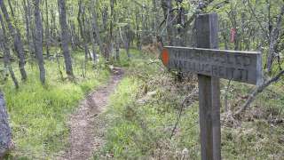
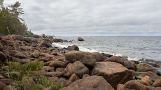
Björkö-Panike hiking trails
The archipelago section of the Björkö-Panike hiking trail
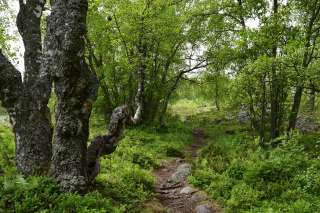
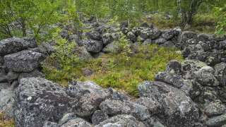
The archipelago section of the Björkö-Panike hiking trail is 8 km long and primarily traverses the island of Slåttskäret, right in the heart of the World Heritage site. Along the way, you’ll walk on uplifted shores shaped by post-glacial rebound, pass overgrown sea bays, cross narrow straits, and wander through birch groves used for summer grazing. The birch forests in the area are rich in windthrows and hollow trees, creating valuable habitats for a wide variety of plant and animal species. From June to October, sheep graze freely in the archipelago, helping to maintain the traditional landscape. The trail is equipped with lean-tos, designated camping areas, cooking shelters, and campfire sites.
A ferry operates from the Långgrund jetty to Stora Segelsören. Boat transport can also be arranged between Rotörskatan and either Vargis or Panike. Read more about the ferry and how to register as a driver.
The hiking trail is of moderate difficulty, and parts of the trail are rocky or damp.
Starting points:
1. Svedjehamn parking area: Björkövägen 1008, 65870 Björköby. The parking lot has a voluntary parking fee.
2. Vargis parking, Vargisvägen, 65970 Söderudden.The initial part of the trail
The initial part of the trail (Svedjehamn – Långgrundet – Svedjehamn) can be hiked without boat transport and partly as a loop. Depending on the chosen route, the hike can be approximately 7-10 km long.
Difficulty level: The trail is easy to hike, but there are stairs at two locations to cross sheep fences. The trail is partially rocky. The distance between Svedjehamn and the Märaryggen bridge’s observation platform (1 km/ direction) is a challenging accessible trail. No winter maintenance except on the path leading to the Saltkaret observation tower and a part of the parking lot.
Starting point: Svedjehamn parking area, Björkövägen 1008, 65870 Björköby. The parking lot has a voluntary parking fee.
Bodvattnet trail
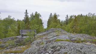
Bodvattnet runt 4-km circle trail, with a demanding accessible section of 1 km or 1.4 km / each way
About 100 years ago, the old fishing port of Bodback set off on dangerous trips across the rocky Kvarken to Umeå. In addition to mail, government officials were also transported. Now only a small creek connects this port to the sea! Come and see how land uplift changes the Kvarken World Heritage landscape.
Difficulty: Demanding accessible.
Estimated travel time: During summertime the entire loop (4 km) on foot 1.5 hours, no winter maintenance.Travel time by wheelchair on one direction:
- The Svedjehamn parking area – Saltkaret observation tower – Märaryggen 1 km, approximately 0.5 hours.
- The Svedjehamn parking area – Bodback old harbour 1.4 km, less than one hour.
The trail between Svedjehamn parking area and Saltkaret observation tower is snow-cleared during wintertime, including the parking area.
https://www.luontoon.fi/en/trails/bjorko-panike-hiking-trail-korsholm-23858-en
-
Bodvattnet runt 4 km circle trail, with a demanding accessible sections of 1 km and 1.4 km / each way
About 100 years ago, the old fishing port of Bodback set off on dangerous trips across the rocky Kvarken to Umeå. In addition to mail, government officials were also transported. Now only a small creek connects this port to the sea! Come and see how land uplift changes the Kvarken World Heritage landscape.
Difficulty: Demanding accessible.
Estimated travel time: During summertime the entire loop (4 km) on foot 1.5 hours, no winter maintenance.
Travel time by wheelchair on one direction:- The Svedjehamn parking area – Saltkaret observation tower – Märaryggbirdge 1 km, approximately 0.5 hours.
- The Svedjehamn parking area – Bodback old harbour 1.4 km, less than one hour.
The trail between Svedjehamn parking area and Saltkaret observation tower is snow-cleared during wintertime, including the parking area.
Starting point: The Svedjehamn fishing harbour parking area Address: Svedjehamn fishing harbour, 65870 Svedjehamn. The parking area does not have separate accessible parking spaces, but there is usually plenty of space. The parking area’s surface material is gravel. The parking area is flat.
https://www.luontoon.fi/en/trails/bodvattnet-trail-korsholm-62410-en
-
In Klobbskat there is a short nature trail which leads to Kikanberget (0,8 km). It starts from the observation tower in Klobbskat and leads along the shore to the top of Kikanberget.
Sit down for a moment to relax and let your gaze rest on the seascape. From the obervation tower you can spot the Kvarken’s beautiful natural heritage from a total height of 25 meters. With the naked eye, the lighthouses are distinguished at Norrskär, Utgrynnan and Valsörarna. In the spring and autumn, the observation tower is a good place for bird watching. The trail goes back and forth, and its total length both ways is approximately 800 metres. The trail is not maintained in the winter.
https://www.luontoon.fi/en/trails/kikanbergets-nature-trail-korsholm-74125-en
-
Mickelsörarna Nature Trail on Kummelskär Island is about 2 km long. The thematic trail starts from the yard of the nature information station. At first, the trail runs 200 metres along a back-and-forth trail, after which the circle trail section begins. It is possible to take a detour to the seashore halfway through the circle trail to admire the scenery. You will have to walk a total of 500 extra metres if you choose to take the detour. Then, you will return to the circle trail section. Once you have travelled the entire circle trail, you will return to the trail that takes you back to the starting point.
Along this nature trail, visitors are able to see the geology, vegetation and animals of the land uplift shores, foundations of old fishing huts and boat docks from the 16th century. Please note that the trail can only be accessed by water.
There is a lean-to shelter, a campfire site and a dry toilet as well as a rental sauna in the harbour at the starting point. You can climb the observation tower in the summer, when the nature information hut is open. A summer café operates in connection with the nature information station.
https://www.luontoon.fi/en/trails/mickelsorarna-nature-trail-voyri-63857-en
-
Molpehällorna Nature Trail is about 2 km long and starts from the yard of the Molpe Nature station. The trail is a circular route, with a spur leading to the Molpehällorna beacon. The circular part of the route is one kilometer long, and visiting the beacon adds another kilometer.
Along the nature trail you’ll see the geology, vegetation and animals of the land uplift shores as well as a reconstruction of the Molpehällorna “vippbåk” beacon (which is a memorial for the first beacon in the Gulf of Bothnia).
The trail is available only by boat.
https://www.luontoon.fi/en/trails/molpehallorna-nature-trail-korsnas-35566-en
-
The Sommarö Nature Trails are located in the area of the former Sommarö fort, in Södra Vallgrund. The trail network consists of two circle trails and a back-and-forth trail that branches off, leading to the Södra Vallgrund Beach in Sommarösund past the giant’s kettle and cultural landscapes. In addition to the marine landscapes, you can spot signs of the Finnish Defence Forces’ activities.
The longer trail leads to the Sommarösund beach in Södra Vallgrund (7 km). The shorter circular trail is 1.5 kilometres long, and the section that goes around the Hålören peninsula is one kilometre long. There are two campfire sites and dry toilets, tables and benches, and an accessible viewpoint along the paths. In the yard of the Sommarö guardhouse there is a lean-to shelter (in public use). An information board (including maps) at each end of the trail and information boards along the trail.
https://www.luontoon.fi/en/trails/sommaro-nature-trail-korsholm-61409-en
-

Valsörarna Nature Trail is a 3 km long nature trail from the pier of Ebbskär in the north to the pier of Storskäret in the south. Attractions along the thematic trail on the Valsörarna Islands include a lighthouse and lighthouse keepers’ buildings, fishing huts, ribbed moraine clusters, i.e., Rogen-type moraines and fladas, and a memorial for Russian soldiers. A biological station maintained by Ostrobothnia australis rf, established in 1966 mainly for bird observation and research, is also located on the Valsörarna Islands.
Valsörarna is an island group located outer in the Kvarken, about 15 km Northwest from Björkö. Already in the 1948 Valsörarna has been a birdprotection area.
The nature trail is available only by boat.
https://www.luontoon.fi/en/trails/valsorarna-nature-trail-korsholm-70006-en
-
Hiking route from Vikarskat fishing harbour to Finnhamn and back – 5 kilometers in total.
https://korsholm.fi/valfard/fritidsverksamhet/naturstigar-och-friluftsleder/vikarskat
-
Västerö Hiking Trails are situated in the outer archipelago of the municipality of Vörå and can be reached by car. The trail starts from the parking areas on Söderskatavägen and Equityvägen, and the visitor can choose trails from 3 km up to 12 km. A map for the area is found in the parking area. There are also maps along the trail.
Along the trails there are a memorial for the Equity (a ship that carried weapons during the civil war in Finland), the cliffs of Ryssberget, the old land uplift forests, bays, flads and seashores. In the distance, you can see the Mickelsörarna archipelago.
There are campfire sites and resting spots, dry toilets, two huts to be used as rest spots (they are not meant for overnight stays). NOTE! No wood supply.
https://www.luontoon.fi/en/trails/vastero-hiking-trail-voyri-63614-en
-
Desitnations and trails in the service Luontoon
You can find information on all outdoor recreation destinations, trails and services throughout Finland on the Luontoon service.