
Activities and Nature
Search for interesting activities by type and / or area or with the help of keywords, end by pressing "Show results"
32 Search results, page 1/2
Clear filters-
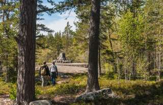
Björkö-Panike hiking trails
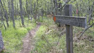
The archipelago section of the Björkö-Panike hiking trail
The archipelago section of the Björkö-Panike hiking trail is 8 km long and primarily traverses the island of Slåttskäret, right in the heart of the World Heritage site. Along the trail, one can experience the tranquility of the archipelago and witness the specialties of land uplift, such as moraine ridges and secluded sea inlets. During the summer, the island serves as traditional grazing land for sheep.
To access the route on Slåttskäret, one must arrange boat transport across the strait either from the Panike side or the Björköby side. In Björköby, the journey can begin either from Svedjehamn or from the Långgrundet rest area (the hike from Svedjehamn to Långgrundet is approximately 3.5 km).
The hiking trail is of moderate difficulty, and parts of the trail are rocky or damp.
Starting points:
1. Svedjehamn parking area: Björkövägen 1008, 65870 Björköby. The parking lot has a voluntary parking fee.
2. Vargis parking, Vargisvägen, 65970 Söderudden.The initial part of the trail
The initial part of the trail (Svedjehamn – Långgrundet – Svedjehamn) can be hiked without boat transport and partly as a loop. Depending on the chosen route, the hike can be approximately 7-10 km long. Further description of the trail.
Difficulty level: The trail is easy to hike, but there are stairs at two locations to cross sheep fences. The trail is partially rocky. The distance between Svedjehamn and the Märaryggen bridge’s observation platform (1 km/ direction) is a challenging accessible trail. No winter maintenance except on the path leading to the Saltkaret observation tower and a part of the parking lot.
Starting point: Svedjehamn parking area, Björkövägen 1008, 65870 Björköby. The parking lot has a voluntary parking fee.
Bodvattnet trail
Bodvattnet runt 4-km circle trail, with a demanding accessible section of 1 km or 1.4 km / each way
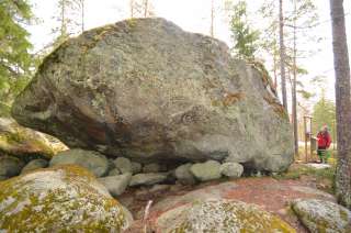
About 100 years ago, the old fishing port of Bodback set off on dangerous trips across the rocky Kvarken to Umeå. In addition to mail, government officials were also transported. Now only a small creek connects this port to the sea! Come and see how land uplift changes the Kvarken World Heritage landscape.
Difficulty: Demanding accessible.
Estimated travel time: During summertime the entire loop (4 km) on foot 1.5 hours, no winter maintenance.Travel time by wheelchair on one direction:
- The Svedjehamn parking area – Saltkaret observation tower – Märaryggbirdge 1 km, approximately 0.5 hours.
- The Svedjehamn parking area – Bodback old harbour 1.4 km, less than one hour.
The trail between Svedjehamn parking area and Saltkaret observation tower is snow-cleared during wintertime, including the parking area.
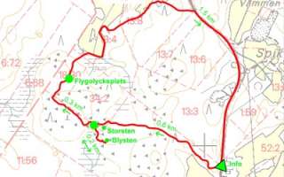
Map of Björkö-Panike hiking trails.
https://www.nationalparks.fi/description-of-trails#BjorkoPanikeHikingArchipelago
-
Bodvattnet runt 4 km circle trail, with a demanding accessible sections of 1 km and 1.4 km / each way
About 100 years ago, the old fishing port of Bodback set off on dangerous trips across the rocky Kvarken to Umeå. In addition to mail, government officials were also transported. Now only a small creek connects this port to the sea! Come and see how land uplift changes the Kvarken World Heritage landscape.
Difficulty: Demanding accessible.
Estimated travel time: During summertime the entire loop (4 km) on foot 1.5 hours, no winter maintenance.
Travel time by wheelchair on one direction:- The Svedjehamn parking area – Saltkaret observation tower – Märaryggbirdge 1 km, approximately 0.5 hours.
- The Svedjehamn parking area – Bodback old harbour 1.4 km, less than one hour.
The trail between Svedjehamn parking area and Saltkaret observation tower is snow-cleared during wintertime, including the parking area.
Starting point: The Svedjehamn fishing harbour parking area Address: Svedjehamn fishing harbour, 65870 Svedjehamn. The parking area does not have separate accessible parking spaces, but there is usually plenty of space. The parking area’s surface material is gravel. The parking area is flat.
https://www.nationalparks.fi/description-of-trails#BodvattnetruntTrail
-
Start from Brännarsvägen 730.
Routs: 1.7 km, 3.5 km and about 6 km.Along the trail a small barbecue place and a bench for resting.
https://www.vora.fi/tjanster/motion-och-idrott/vandringsleder/
-
The trail 3,6 kilometers long trail starts from Tottesund Manor and goes through the Manor Park, from there it takes a turn to Bytesholmsudden and returns to the Manor. The terrain varies from a and easily walked dirt road to small trails.
https://www.vora.fi/tjanster/motion-och-idrott/vandringsleder/
-
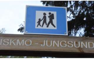
The trail goes through the scenic area around the lakes in Iskmo and Jungsund and starts at Jungsund sports field, Jungsund road 641. You can choose distances from 1.8 km up to 12 km. Picnic areas with the possibility of grilling, you will find at Strömssund (2 km from the start), at Kråknässkatan (3 km from start) and at Björnhällorna (6.5 km from the start). You can also start your hike from Hallonnäs, Tistronskärsvägen 98.
You find printed maps of the trail at the starting places and also as PDF-files from this page. -
The hiking trail begins at the Kajane camping area located along the Kajane forest road, approximately 2.6 km from National Road 8. The Kajane camping area is situated next to a large bog near Lillträsket and Lisansjön. The Kajane hiking trail itself is 3 km long. The trail partly runs on boardwalks across the bog and extends to Lisansjön. Map indicating the hiking trail is marked (pdf).
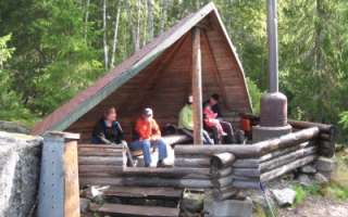
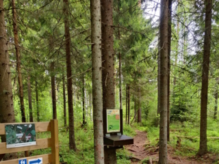
Along the hiking trail, informational signs are placed, providing details about the area’s fauna and flora. The trail leads to Lillträsket (0.8 km) where a shelter is available. At the Kajane camping area, there is also a sauna, overnight cabin, and several barbecue shelters. A fee is charged for the use of the cabin and sauna.
The maintenance of the Kajane hiking trail is overseen by the Yrkesakademin in Österbotten.
For booking the area’s overnight cabin and more information.
-
Start from Kimo Bruk, Bruksgatan 38.
Parking is available up by the road. The trails are 1.5 km, 3 km, and 8 km.
Four rest areas with tables and benches are provided. The 1.5 km and 3 km trails are wide gravel paths suitable for strollers and, with assistance, wheelchairs, depending on the weather and season. The 8 km route includes partly uneven terrain.
Here you can find more information, a printable map, and an interactive map where you can explore the trail online.
Maps and a more detailed brochure are available for purchase at Kimo Bruk Museum and Gallery, as well as at Einar’s Café:
Conclude your hike with a leisurely stroll through the beautiful industrial park and take a lap around the “virgin dance” or stone labyrinth at the bruk (ironworks).
https://www.vora.fi/tjanster/motion-och-idrott/vandringsleder/
-
Signs from Lotlaxvägen, Vörå. Längd: 3, 5 km.
Halvvägs finns en rastplats med bordsgrupper.The hiking trail of about 3.5 kilometers was laid out in the late 1980s by Lars Hannus and restored by the local community association in the summer of 2014. About halfway there is a rest area with table groups where you can pause and enjoy the tranquility.
https://www.vora.fi/tjanster/motion-och-idrott/vandringsleder/
-
Majors Nature Trail begins at Strandvägen 2118, 6 km south of Pappadagis Neste. There is a large parking area at the beginning of the trail. Along the path, you can walk 1.2 km, 2.2 km, or 3.4 km.
The trail is marked with blue ribbons and informational signs. The shorter trail (1.2 km) with more hilly areas has stairs. There is also a cozy rest area with log tables.
Map indicating the hiking trail is marked (pdf).
-
A 2,6 kilometres long nature trail in Kuni, Korsholm.
https://korsholm.fi/valfard/fritidsverksamhet/naturstigar-och-friluftsleder/malsorleden
-
Starting Point: The parking area is located next to Peippoos Disc Golf Course, along Peippoostentie just to the left shortly after the playground.
Length: Several circular routes ranging from 1 km to 3 km.
Difficulty: Easy.
Walking Time: Approximately 45 minutes for the 3 km route.
Adjacent to the parking lot is the gravel-covered Kylkkälä Fitness Trail, which is groomed in winter. Walking on the ski tracks is not allowed. There is also a disc golf course along with the fitness trail, so exercise caution regarding flying discs. The starting point of the nature trails is on the opposite side of Peippoostentie. The first 200 meters follow the pedestrian path uphill to the beginning of the trail, and the return point of the route is near the parking area. The nature trail is intended to be walked clockwise. The routes offer a true nature experience right in the vicinity of residential areas. The trail network is diverse, providing plenty of options for hikers. Along the nature trail, you’ll find a fireplace, and next to the fitness trail, there is also a lean-to shelter.
https://isokyro.fi/vapaa-aika-ja-matkailu/liikunta/luontoreitit/patikkareitisto/
-

Variable and beautiful nature, swamp, old forest and the mythical Björnberget, paths partly made by people and animals under a period of 100 – 200 years and a ribbon of small lakes and rest areas – that`s how to describe Petsmo Vandringsled.
You can walk a distance from 0,6 km up to 12,5 km, depending how you choose your route. The walking trail has two start places and if you choose to walk the whole trail you get to experience all four campfire places, all of them unique in their own way, but all with fantastic views.
Read more about the walking trail here
info@petsmovandringsled.fi
-
The Pilvilampi recreational area is located approximately nine kilometers east of the city centre. It makes up a proportion of an elongated ridge, of which includes Höstvesi and continues north of Vaasa. The recreational area itself covers an area of roughly 800 hectares. In the winter, the area is ridden with marked cross-country ski trails, which in summer are transformed into bicycle and hiking paths.
Download brochure for the nature path at Pilvilampi here.
https://www.vaasa.fi/en/living/freetime/naturevaasa/attractions/natural-environments/pilvilampi/
-
The nature trail starts fråm Klockarisvägen 14, close to the cross roads with Klockarisgränd.
The nature trail is divided into three parts, and you can walk different distances: 1.8 km, 3.1 km, 3.4 km, and 4.5 km.
-
Risnästräskstigen in Övermark, 0.9 km to the barbecue hut at Risnästräsket and 2.1 km around the swamp.
Start from the parking spot at Heide forest road, coordinates ETRS-TM35FIN N: 6963477 E: 214123
-
Risö ja Ryövärinkari 4.9 kilometres
The Eteläinen Kaupunginselkä bay (the Southern City Bay) is located southeast of Vaasa city centre. There’s a nature trail and two bird towers in the area. Follow the signs ´Lintutorni` from the crossroad of the streets: Kanavasillantie/Hevossaarentie. Parking area at the end of road Ampujantie.
Coordinates: Euref-Fin (~ WGS84) lat: 63° 03.7663′ lon: 21° 41.9537’ETRS-TM35FIN N: 7003634 E: 232305
https://www.nationalparks.fi/kvarken/descriptionoftrails#RisoNatureTrail
-
The Rööki trail combines many different elements. At the starting point, there is a well-equipped beach at Ruusupuro, from where the trail goes through a majestic forest. The diverse natural elements in the area provide variation and challenges for the trail. Near the Rööki lean-to, bird boxes have been installed along the trail, so at the midpoint of the trail, you can sit by the fire and observe the life of birds up close.
- Starting point: Ruusupurontie 769.
- Length: 5 km circular route
- Difficulty: Challenging
- Walking time: 1.5 to 2 hours
- Map and GPX file can be found on the website.
https://isokyro.fi/vapaa-aika-ja-matkailu/liikunta/luontoreitit/patikkareitisto/
-
Signs from Norrvalla, Vöråvägen 305-307.
Routes from 3 km to 7 km.The connecting route between Bobergsleden and Vitmossleden provides the opportunity for long trips as the distance is over 20 km round trip. Shorter stages can also be hiked along the trail as it passes several slip roads along the forest road in Rökiö where you can start.
You experience varied nature in the form of boulders, old magic forest, bogs and swamps as well as ancient relics.Karta Norrvalla-Boberget
Karta Norrvalla-Boberget-Lasor-Vitmossenhttps://www.vora.fi/tjanster/motion-och-idrott/vandringsleder/
-
The Sommarö Nature Trail is located in the area of the former Sommarö fort, in Södra Vallgrund.
There are two trails in the area. The shorter circular trail (1.5 km/2.4 km) leads through a memorial for the coastal artillery fort to the beach at the camping area. The longer trail leads to the Sommarösund beach in Södra Vallgrund (7 km). Along the longer trail, you will see a geologically fascinating giant’s kettle, as well as cultural landscape (including stone fences).
There are two campfire sites and dry toilets, tables and benches along the Paths. In the yard of the Sommarö guardhouse there is a lean-to shelter (in public use). An information board (including maps) at each end of the trail and five information boards along the trail.
https://www.nationalparks.fi/kvarken/descriptionoftrails#SommaroNatureTrail
-
Welcome to a walk from the Öjbergsmossen bog to a giant’s pot hole and over a devil’s field to the dwarfed pinetree-covered meteorite-crater rim of Söderfjärden
Öjberget is located in Sundom, at a 9 km distance from the centre of Vaasa. The trail is 2,5 km long and the starting point is beside a big information board in Öjberget´s stadium area.
Öjberget is a unique ”mountain landscape” for the Ostrobothnian coast, with its highest point at an elevation of 50 metres. It is a magically rocky landscape with very old dwarfed pine trees, dramatic rocky formations, a giant’s kettle, and an ancient shore area called the Devil’s Field
The most ancient traces of human activity in the area of Vaasa are also found here. The findings originate from the Stone Age about 4,000 years ago.
In the outlook tower(+65 m a.s.l.) on the top of the slalom hill there are info boards about what you see in different directions: the meteorite impact crater Söderfjärden, the Kvarken archipelago, the village of Sundom and the centre of Vaasa.