
Activities and Nature
Search for interesting activities by type and / or area or with the help of keywords, end by pressing "Show results"
64 Search results, page 1/4
Clear filters-
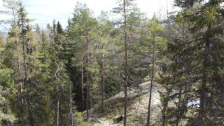
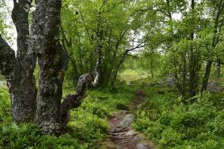
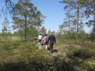
Andkil hiking trail consists of two stretches, one of 1.7 km and a longer round of almost 9 km.
Signs to the trail from Rejpeltvägen / Torrkullvägen and on towards Kondivorvägen.
The first part of the longer stretch, consists of rising terrain, partly over boulders and rocks. Then you continue through forest, land and open landscapes. The highest point of the trail is 52 meters above sea level. Along the latter part of the trail there are places marked with signs, where the names of the places are written in dialect. The name of the places has come from old legends. Let your imagination live and invent the story behind the names of the places.
https://www.vora.fi/tjanster/motion-och-idrott/vandringsleder/
-
Start: Haviståkersvägen 95, Vörå. The paths start behind the outbuilding at Arvidsgården.
Distance: Arvidsstigen 1.3 km, Vernersstigen 1.5 kmSuitable for everyone. Also available with pram. During the summer, there are fairy tale characters and toy animals along the paths.
https://www.vora.fi/tjanster/motion-och-idrott/vandringsleder/
-
In Bergö, you will find a beautiful hiking trail that takes you through the most scenic forest areas of Granö. Along the hiking trail, there are resting places, information boards, and artworks, as well as the grill hut Adolf, where you can take a break while grilling sausages or enjoying your packed lunch.
You can choose to walk 3.5 km or 8 km.
-
Björkö-Panike hiking trails
The archipelago section of the Björkö-Panike hiking trail
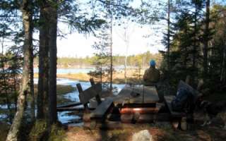
The archipelago section of the Björkö-Panike hiking trail is 8 km long and primarily traverses the island of Slåttskäret, right in the heart of the World Heritage site. Along the way, you’ll walk on uplifted shores shaped by post-glacial rebound, pass overgrown sea bays, cross narrow straits, and wander through birch groves used for summer grazing. The birch forests in the area are rich in windthrows and hollow trees, creating valuable habitats for a wide variety of plant and animal species. From June to October, sheep graze freely in the archipelago, helping to maintain the traditional landscape. The trail is equipped with lean-tos, designated camping areas, cooking shelters, and campfire sites.
A ferry operates from the Långgrund jetty to Stora Segelsören. Boat transport can also be arranged between Rotörskatan and either Vargis or Panike. Read more about the ferry and how to register as a driver.
The hiking trail is of moderate difficulty, and parts of the trail are rocky or damp.
Starting points:
1. Svedjehamn parking area: Björkövägen 1008, 65870 Björköby. The parking lot has a voluntary parking fee.
2. Vargis parking, Vargisvägen, 65970 Söderudden.The initial part of the trail
The initial part of the trail (Svedjehamn – Långgrundet – Svedjehamn) can be hiked without boat transport and partly as a loop. Depending on the chosen route, the hike can be approximately 7-10 km long.
Difficulty level: The trail is easy to hike, but there are stairs at two locations to cross sheep fences. The trail is partially rocky. The distance between Svedjehamn and the Märaryggen bridge’s observation platform (1 km/ direction) is a challenging accessible trail. No winter maintenance except on the path leading to the Saltkaret observation tower and a part of the parking lot.
Starting point: Svedjehamn parking area, Björkövägen 1008, 65870 Björköby. The parking lot has a voluntary parking fee.
Bodvattnet trail
Bodvattnet runt 4-km circle trail, with a demanding accessible section of 1 km or 1.4 km / each way
About 100 years ago, the old fishing port of Bodback set off on dangerous trips across the rocky Kvarken to Umeå. In addition to mail, government officials were also transported. Now only a small creek connects this port to the sea! Come and see how land uplift changes the Kvarken World Heritage landscape.
Difficulty: Demanding accessible.
Estimated travel time: During summertime the entire loop (4 km) on foot 1.5 hours, no winter maintenance.Travel time by wheelchair on one direction:
- The Svedjehamn parking area – Saltkaret observation tower – Märaryggen 1 km, approximately 0.5 hours.
- The Svedjehamn parking area – Bodback old harbour 1.4 km, less than one hour.
The trail between Svedjehamn parking area and Saltkaret observation tower is snow-cleared during wintertime, including the parking area.
https://www.luontoon.fi/en/trails/bjorko-panike-hiking-trail-korsholm-23858-en
-
Bodvattnet runt 4 km circle trail, with a demanding accessible sections of 1 km and 1.4 km / each way
About 100 years ago, the old fishing port of Bodback set off on dangerous trips across the rocky Kvarken to Umeå. In addition to mail, government officials were also transported. Now only a small creek connects this port to the sea! Come and see how land uplift changes the Kvarken World Heritage landscape.
Difficulty: Demanding accessible.
Estimated travel time: During summertime the entire loop (4 km) on foot 1.5 hours, no winter maintenance.
Travel time by wheelchair on one direction:- The Svedjehamn parking area – Saltkaret observation tower – Märaryggbirdge 1 km, approximately 0.5 hours.
- The Svedjehamn parking area – Bodback old harbour 1.4 km, less than one hour.
The trail between Svedjehamn parking area and Saltkaret observation tower is snow-cleared during wintertime, including the parking area.
Starting point: The Svedjehamn fishing harbour parking area Address: Svedjehamn fishing harbour, 65870 Svedjehamn. The parking area does not have separate accessible parking spaces, but there is usually plenty of space. The parking area’s surface material is gravel. The parking area is flat.
https://www.luontoon.fi/en/trails/bodvattnet-trail-korsholm-62410-en
-
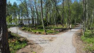
The first part of the nature trail around Vaasa Southern City Bay (Eteläinen kaupunginselkä – Södra Stadsfjärden) is now complete (opening 1.6.2022). The ten kilometer long trail runs along the shores of Vaasa from Kalaranta all the way to Risö, and along the trail, new rest areas and a completely new bridge over the Old Vaasa canal have been built.
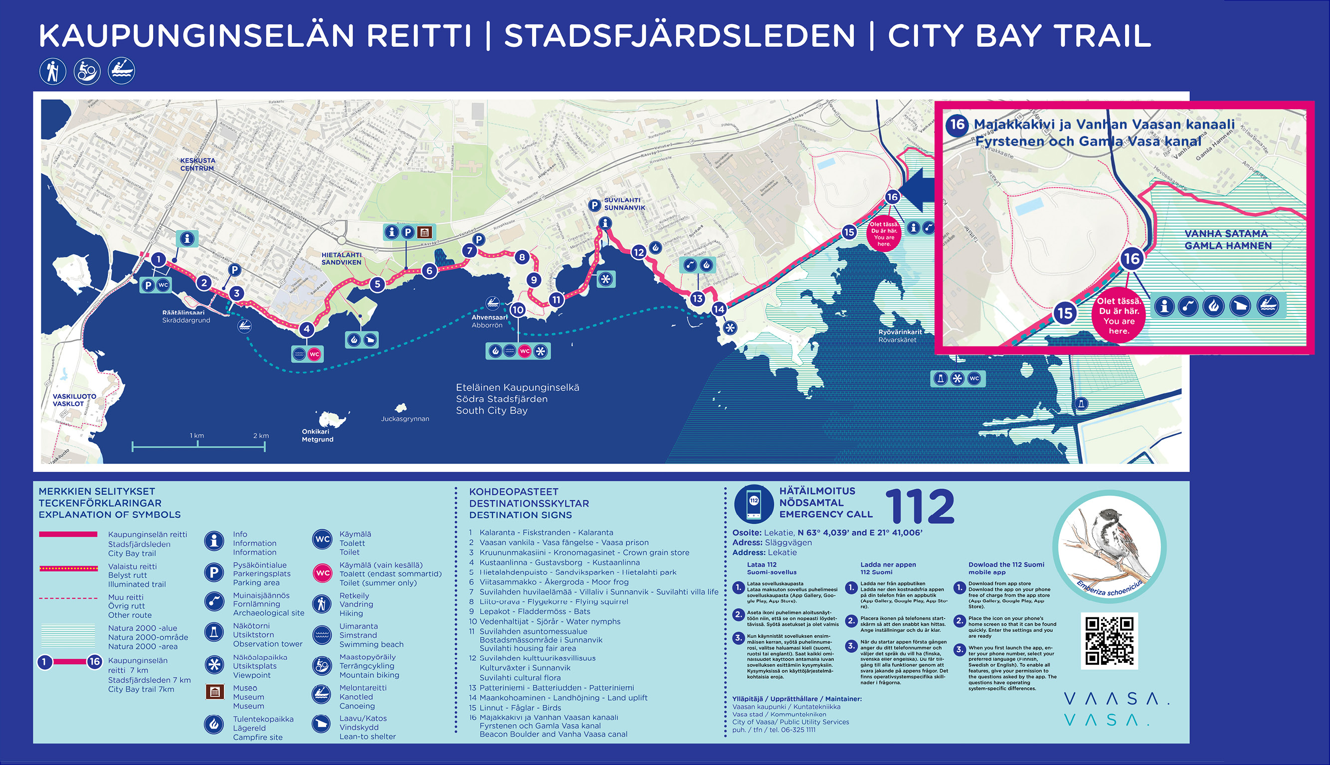
Facts about the route
- Kalaranta-Risö is the beginning of an approximately 30 kilometers long outdoor trail around the City Bay.
- Along the trail, rest areas, benches and landing places for paddlers have been built. In addition, the lighting and signs have been improved.
- On the trail there are several culturally and historically valuable objects, which signs erected along the trail tell more about.
- The trail is mostly accessible and, for example, from Suvilahti there is a two-meter-wide accessible passage all the way to Majakkakivi.
-
Start from Brännarsvägen 730.
Routs: 1.7 km, 3.5 km and about 6 km.Along the trail a small barbecue place and a bench for resting.
https://www.vora.fi/tjanster/motion-och-idrott/vandringsleder/
-
About 45 kilometres long hiking route through the Nature reserve Levaneva. Starting from Rajavuoren Wild Life and Hiking Centre in Laihia.
-
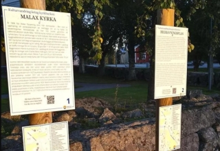
Take a guided tour through historical sites around the church hill in Malax, individually or in a group. The walk is accessible. Along the walk, we have placed 16 signs with information about the sites, a QR code for more material, and a map of the area. The entire route is 4.6 km but can be adjusted as needed. Start from Malax Church, Mattlarsvägen 1, Malax.
-
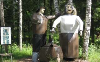
History and culture in the form of Edvin Hevonkoski’s wooden and metal sculptures, in the middle of the nature along the nature trail in Asevelikylä. At the moment there are over 100 named works of art or groups of works of art. The Korsu Museum consists of a crew bunker filled with wartime objects, the maintenance bunker Töpinä and a smoke sauna, all authentic from World War II.
+358 50 560 6496
-
Erklasstigen nature trail in Pörtom 2 km turn and return. Start from the graveyard in Pörtom village.
Coordinates; ETRS-TM35FIN N: 6964124 E: 224240
-
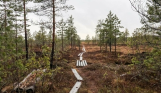
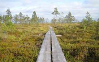
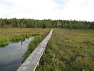
The initial part of the hiking trail on Fatisaari winds through varied terrain until vast bog landscapes unfold before your eyes. Thanks to over a kilometer-long boardwalk, you can admire the marsh landscapes with dry feet. Along this boardwalk, hikers can breathe in the scent of the marsh and take a break at the majestic rock on Fatisaari’s summit, where there is a lean-to shelter. Later, you get to enjoy the beautiful nature once again as you follow the same trail back to the starting point.
- Starting point: From Tulisalontie 525, turn onto Marjoniementie, continue until a narrow road turns right at Tuuralan hunting lodge. The trail is found at the end of this road. Park your car in a way that doesn’t obstruct other road users. Do not park in the hunting lodge yard!
- Length: Approx. 6 km round trip
- Difficulty: Easy
- Walking time: 1.5 to 2 hours
- Map at the web page
- GPX file available here.
https://isokyro.fi/vapaa-aika-ja-matkailu/liikunta/luontoreitit/patikkareitisto/
-
Fållbäckstigen on Högåsen in Övermark runs through the forest south of Högåsen. It is a 6.5 km long path that goes through varying terrain and is marked with yellow marks.
Start from Högåsen’s sports cabin, coordinates ETRS-TM35FIN N: 6951949 E: 219851
In winter there is a ski trail here
-
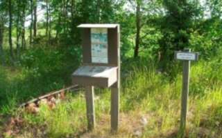
The rich pasture system in Malax can be experienced along this trail. Fifteen old chalet foundations have been marked along the beautiful path. At the beginning of the trail there is a board with a map and a box of brochures and along the path there are signs showing where the 15 cabins stood. The trail is about 1 km long.
-
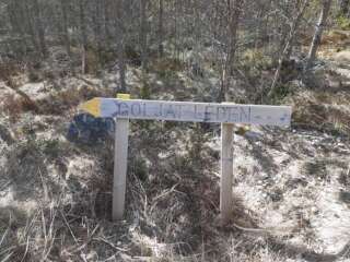
Goljatlelden is about 18 km long and marked in the terrain with signs and yellow markings. Goljatleden starts at the corner of the biathlon arena at Vargberget’s leisure center. The trail goes from Vargberget to the forest around Svartbäck and there you also find rest cabins.
Coordinates ETRS-TM35FIN N: 6942607 E: 215212
-
Hamnsträskets hiking trail is located on Södra Björkö in Harrström. The swamp has a rich bird life and in the scenic area by the swamp there is a large lookout tower.
The trail is about 2 km long and there is a barbecue area by the swamp.
More information on www.harrstrom.fi
https://www.korsnas.fi/bibliotek-kultur-fritid/vandringsleder/
-
The trail 3,6 kilometers long trail starts from Tottesund Manor and goes through the Manor Park, from there it takes a turn to Bytesholmsudden and returns to the Manor. The terrain varies from a and easily walked dirt road to small trails.
https://www.vora.fi/tjanster/motion-och-idrott/vandringsleder/
-
The trail goes through the scenic area around the lakes in Iskmo and Jungsund and starts at Jungsund sports field, Jungsund road 641. You can choose distances from 1.8 km up to 12 km. Picnic areas with the possibility of grilling, you will find at Strömssund (2 km from the start), at Kråknässkatan (3 km from start) and at Björnhällorna (6.5 km from the start). You can also start your hike from Hallonnäs, Tistronskärsvägen 98.
You find printed maps of the trail at the starting places and also as PDF-files from this page. -
The trail can be walked on a 800 m route or a 1.8 kilometers route.
Well marked nature trail where you can acquaint yourself with cairns and cup stones from the Iron Age. The area was inhabited 200-700 A.D. Exuberant flora.
-
The hiking trail begins at the Kajane camping area located along the Kajane forest road, approximately 2.6 km from National Road 8. The Kajane camping area is situated next to a large bog near Lillträsket and Lisansjön. The Kajane hiking trail itself is 3 km long. The trail partly runs on boardwalks across the bog and extends to Lisansjön. Map indicating the hiking trail is marked (pdf).
Along the hiking trail, informational signs are placed, providing details about the area’s fauna and flora. The trail leads to Lillträsket (0.8 km) where a shelter is available. At the Kajane camping area, there is also a sauna, overnight cabin, and several barbecue shelters. A fee is charged for the use of the cabin and sauna.
The maintenance of the Kajane hiking trail is overseen by the Yrkesakademin in Österbotten.
For booking the area’s overnight cabin and more information.