
Activities and Nature
Search for interesting activities by type and / or area or with the help of keywords, end by pressing "Show results"
64 Search results, page 3/4
Clear filters-
The Rööki trail combines many different elements. At the starting point, there is a well-equipped beach at Ruusupuro, from where the trail goes through a majestic forest. The diverse natural elements in the area provide variation and challenges for the trail. Near the Rööki lean-to, bird boxes have been installed along the trail, so at the midpoint of the trail, you can sit by the fire and observe the life of birds up close.
- Starting point: Ruusupurontie 769.
- Length: 5 km circular route
- Difficulty: Challenging
- Walking time: 1.5 to 2 hours
- Map and GPX file can be found on the website.
https://isokyro.fi/vapaa-aika-ja-matkailu/liikunta/luontoreitit/patikkareitisto/
-
Signs from Norrvalla, Vöråvägen 305-307.
Routes from 3 km to 7 km.The connecting route between Bobergsleden and Vitmossleden provides the opportunity for long trips as the distance is over 20 km round trip. Shorter stages can also be hiked along the trail as it passes several slip roads along the forest road in Rökiö where you can start.
You experience varied nature in the form of boulders, old magic forest, bogs and swamps as well as ancient relics.Karta Norrvalla-Boberget
Karta Norrvalla-Boberget-Lasor-Vitmossenhttps://www.vora.fi/tjanster/motion-och-idrott/vandringsleder/
-
10 km (5+5 km)
Starts at Skatila Sports ground and ends at Storhällebergethttps://korsholm.fi/valfard/fritidsverksamhet/naturstigar-och-friluftsleder/skatila-vandringsled
-
The Sommarö Nature Trail is located in the area of the former Sommarö fort, in Södra Vallgrund.
There are two trails in the area. The shorter circular trail (1.5 km/2.4 km) leads through a memorial for the coastal artillery fort to the beach at the camping area. The longer trail leads to the Sommarösund beach in Södra Vallgrund (7 km). Along the longer trail, you will see a geologically fascinating giant’s kettle, as well as cultural landscape (including stone fences).
There are two campfire sites and dry toilets, tables and benches along the Paths. In the yard of the Sommarö guardhouse there is a lean-to shelter (in public use). An information board (including maps) at each end of the trail and five information boards along the trail.
https://www.nationalparks.fi/kvarken/descriptionoftrails#SommaroNatureTrail
-

A European pilgrimage route through coastal Ostrobothnia. Connects up with the Norwegian-Swedish route St. Olavsleden, which leads to Trondheim. A total of 500 km long when complete.
-
Hiking Trails 6,6 kilometers (2 km) through the culture surroundings of Solf and Stundars in the municipality of Korsholm.
https://korsholm.fi/valfard/fritidsverksamhet/naturstigar-och-friluftsleder/stundars-vandringsleder
-
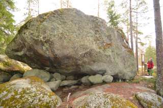
Welcome to a walk from the Öjbergsmossen bog to a giant’s pot hole and over a devil’s field to the dwarfed pinetree-covered meteorite-crater rim of Söderfjärden
Öjberget is located in Sundom, at a 9 km distance from the centre of Vaasa. The trail is 2,5 km long and the starting point is beside a big information board in Öjberget´s stadium area.
Öjberget is a unique ”mountain landscape” for the Ostrobothnian coast, with its highest point at an elevation of 50 metres. It is a magically rocky landscape with very old dwarfed pine trees, dramatic rocky formations, a giant’s kettle, and an ancient shore area called the Devil’s Field
The most ancient traces of human activity in the area of Vaasa are also found here. The findings originate from the Stone Age about 4,000 years ago.
In the outlook tower(+65 m a.s.l.) on the top of the slalom hill there are info boards about what you see in different directions: the meteorite impact crater Söderfjärden, the Kvarken archipelago, the village of Sundom and the centre of Vaasa.
-
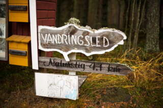
Tjärlax nature trail 4.1 km or a shorter stretch of 1.7 km. Start from Tjärlax holiday village.
Start coordinates ETRS-TM35FIN N: 6936714 E: 201995
Along the hiking trail you encounter nature that is unusual for these areas. The oldest tree in Närpes is also found here.
-
Starting Point: Ventäläntie 670, parking only in the designated parking area, do not block the beginning of the trail with your car.
Length: 4 km circular route.
Difficulty: Moderate.
Walking Time: Approximately 1 hour.
The Tuomaanmäki area is a nature reserve that includes a Bronze Age burial mound. The mounds have been excavated, and stones have been removed. From one of them, apparently, all stones have been taken, leaving only a circular arrangement of stones locally referred to as “käräjäkivet” or judge’s circle. This is the origin of the place’s former name, Tuomarmäki. Tuomaanmäki is an environmentally and geographically splendid Bronze Age burial mound site with significant natural values. Along the route, hikers have the opportunity to explore ancient burial mounds, a “giant’s kettle” (which is not actually a giant’s kettle), diverse nature, and take a break at a campfire site. One of the stories from the mobile game “Tarinapolku” can be found here.
https://isokyro.fi/vapaa-aika-ja-matkailu/liikunta/luontoreitit/patikkareitisto/
-
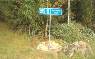
The trail leading to the campfire site at Västernäset is 2.1 kilometers. If you don’t want to walk the same route back you can walk the road through Vikby back to the starting point (3.6 kilometers). The trail is marked with blue/red.
https://korsholm.fi/valfard/fritidsverksamhet/naturstigar-och-friluftsleder/kyrkstigen
-
The trail is about 3 km long. Along the trail there is a lot to see, including a cave, devil’s fields and ancient monuments. At the barbecue area there is also a lookout point where you can enjoy views of Övermark. The trail starts at the Övermark hembygdsgård, but you can also start where the path itself begins at Bergsvägen 34. There is a box with maps at both places, but there are better parking options at Hembygdsgården.
Coordinates for Hembygdsgården: ETRS-TM35FIN N: 6955016 E: 223288
-
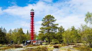
Valsörarna Nature Trail is a 2,5 km long nature trail from the pier of Ebbskär in the north to the pier of Storskäret in the south.
Along the trail you can see the geology, vegetation and animals of the land uplift shores, a memorial for Russian soldiers, and the famous lighthouse.
Valsörarna is an island group located outer in the Kvarken, about 15 km Northwest from Björkö. Already in the 1948 Valsörarna has been a birdprotection area.
The nature trail is available only by boat.
https://www.nationalparks.fi/description-of-trails#ValsorarnaNatureTrail
-
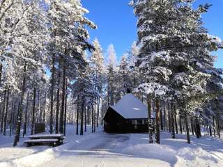
Vargberget leisure center is a lovely and scenic place for exercise or relaxation. Here you can during all 4 seasons enjoy nature and walk, ski, grill, walk the exercise stairs, go roller skiing, practice shooting, swim, pick mushrooms and berries, play in the playground or just enjoy your lunch bag.
https://www.narpes.fi/sv/kultur-fritid-och-unga/idrott/vargbergets-fritidscentrum
-
Velkmossa hiking trail starts on the other side of the road from Velkmoss byagård, Ribackvägen 94 or from Viitala in Petalax. The trail is 9 km long round trip.
The trail is marked with yellow ribbons and yellow paint on trees, along with informational signs. Along the hiking trail, you’ll encounter Nojärv Swamp, where a bird observation tower is located. Nojärv Swamp is a marshy and overgrown wilderness lake, providing a favorable nesting environment for many bird species. Along the hiking trail, there is also a path leading to Kackur Bog as well as ancient graves and old settlements.
Coordinates ETRS-TM35FIN N: 6971020 E: 215932: 215932
-
Rout from Vikarskat fishing harbor to Finnhamnen and back 5 kilometers.
https://korsholm.fi/valfard/fritidsverksamhet/naturstigar-och-friluftsleder/vikarskat
-
Visit Vitmossen’s beautiful forest nature with reconstructed stone and Bronze Age houses. Hike the Bronze Age Trail to the unique settlement with burial cairns. This is one of the oldest settlements found in Finland and dates back to the Early Bronze Age.
Routs 3 km and 5 km.
Signs from Kuckusvägen 1148, Vöråhttps://www.vora.fi/tjanster/motion-och-idrott/vandringsleder/
-
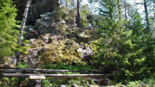
In Vuoressalo, the hiker can ascend from the fields to the top of the majestic white cliffs amidst nature. The cliffs conceal much to see and experience in their shadows. In Vuoressalo, there are many peculiar rock formations, the origins of which have been the subject of speculation over the years. On the current basic map of the area, for example, there is a location called “pakouuni,” a place that, according to legend, is a low, built wall that the farmers participating in the club wars of the 16th century constructed as protection. At the site, there is a natural crack in the rock that forms an approximately 2-meter-high vault. The area is marked by superstition, and these places have not been daringly investigated thoroughly by the locals.
- Starting point: Kuivilantie 174. Parking is available on the opposite side of the road from the starting point. Do not park on the road.
- Length: Two approximately 2 km circular routes
- Difficulty: Easy
- Walking time: 45 minutes to 1 hour
- Map and GPX file are available on the website.
https://isokyro.fi/vapaa-aika-ja-matkailu/liikunta/luontoreitit/patikkareitisto/
-
In the coming years, Vähäkyrö will create, based on the hiking trail development plan 2021, five hiking trail networks:
- Hiking trail network from Kruutari to Mestoosplassi
- Ojaniemi-Hyyriä trail network
- Saarenpää-Mullolan Polkureitti Trail
- Korkiavuoren Luontopolut Nature Trails
- Petulian Patikka Trail
- Map application (in Finish)
In addition, four thematic trails are under development:
- Viiden Sillan Polkureitti Kyrönjoen Varrella (transl. Five bridges along the Kyrönjoki riverbanks Trail) (published in the trail app, to be further developed in 2023)
- Vähäkyrö Children’s Hiking Trail (to be linked to the Ojaniemi-Hyyriä trail)
- Kolkin Patikkapolku hiking trail (this area is listed as a built cultural heritage site of national significance)
- Kirkkosaaren Historiapolku history-themed trail (Kirkkosaari and Kirkkosaari pond, Kaavontönkkä and Vähäkyrö church precinct that are also a built cultural heritage site of national significance)
-
Västerö Hiking Trails are situated in the outer archipelago of the municipality of Vörå and can be reached by car. The trail starts from the parking areas on Söderskatavägen and Equityvägen, and the visitor can choose trails from 3 km up to 12 km. A map for the area is found in the parking area. There are also maps along the trail.
Along the trails there are a memorial for the Equity (a ship that carried weapons during the civil war in Finland), the cliffs of Ryssberget, the old land uplift forests, bays, flads and seashores.
There are campfire sites and resting spots, dry toilets, two huts to be used as rest spots (they are not meant for overnight stays). NOTE! No wood supply.
https://www.nationalparks.fi/description-of-trails#VasteroHiking
-
The Waterloo trail starts at the Waterloo jogging track which is located along Strandvägen between Korsnäs and Molpe (Strandvägen 3681).
The trail runs between the Waterloo area and Lisasgrynnan by the sea shore. Beautiful hiking trail with many different terrain types to hike through. A geocache is also located at one of the rest areas.
The trail is about 7.3 km (3.66 km in one direction).In the same area you will also find a Disc Golf Park, fitness stairs and a playing area for boules.
https://www.korsnas.fi/bibliotek-kultur-fritid/vandringsleder/