
Activities and Nature
Search for interesting activities by type and / or area or with the help of keywords, end by pressing "Show results"
14 Search results, page 1/1
Clear filters-
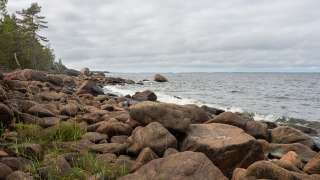
Björkö-Panike hiking trails
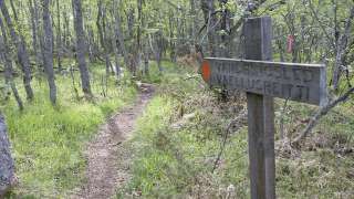
The archipelago section of the Björkö-Panike hiking trail
The archipelago section of the Björkö-Panike hiking trail is 8 km long and primarily traverses the island of Slåttskäret, right in the heart of the World Heritage site. Along the trail, one can experience the tranquility of the archipelago and witness the specialties of land uplift, such as moraine ridges and secluded sea inlets. During the summer, the island serves as traditional grazing land for sheep.
To access the route on Slåttskäret, one must arrange boat transport across the strait either from the Panike side or the Björköby side. In Björköby, the journey can begin either from Svedjehamn or from the Långgrundet rest area (the hike from Svedjehamn to Långgrundet is approximately 3.5 km).
The hiking trail is of moderate difficulty, and parts of the trail are rocky or damp.
Starting points:
1. Svedjehamn parking area: Björkövägen 1008, 65870 Björköby. The parking lot has a voluntary parking fee.
2. Vargis parking, Vargisvägen, 65970 Söderudden.The initial part of the trail
The initial part of the trail (Svedjehamn – Långgrundet – Svedjehamn) can be hiked without boat transport and partly as a loop. Depending on the chosen route, the hike can be approximately 7-10 km long. Further description of the trail.
Difficulty level: The trail is easy to hike, but there are stairs at two locations to cross sheep fences. The trail is partially rocky. The distance between Svedjehamn and the Märaryggen bridge’s observation platform (1 km/ direction) is a challenging accessible trail. No winter maintenance except on the path leading to the Saltkaret observation tower and a part of the parking lot.
Starting point: Svedjehamn parking area, Björkövägen 1008, 65870 Björköby. The parking lot has a voluntary parking fee.
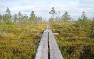
Bodvattnet trail
Bodvattnet runt 4-km circle trail, with a demanding accessible section of 1 km or 1.4 km / each way
About 100 years ago, the old fishing port of Bodback set off on dangerous trips across the rocky Kvarken to Umeå. In addition to mail, government officials were also transported. Now only a small creek connects this port to the sea! Come and see how land uplift changes the Kvarken World Heritage landscape.
Difficulty: Demanding accessible.
Estimated travel time: During summertime the entire loop (4 km) on foot 1.5 hours, no winter maintenance.Travel time by wheelchair on one direction:
- The Svedjehamn parking area – Saltkaret observation tower – Märaryggbirdge 1 km, approximately 0.5 hours.
- The Svedjehamn parking area – Bodback old harbour 1.4 km, less than one hour.
The trail between Svedjehamn parking area and Saltkaret observation tower is snow-cleared during wintertime, including the parking area.
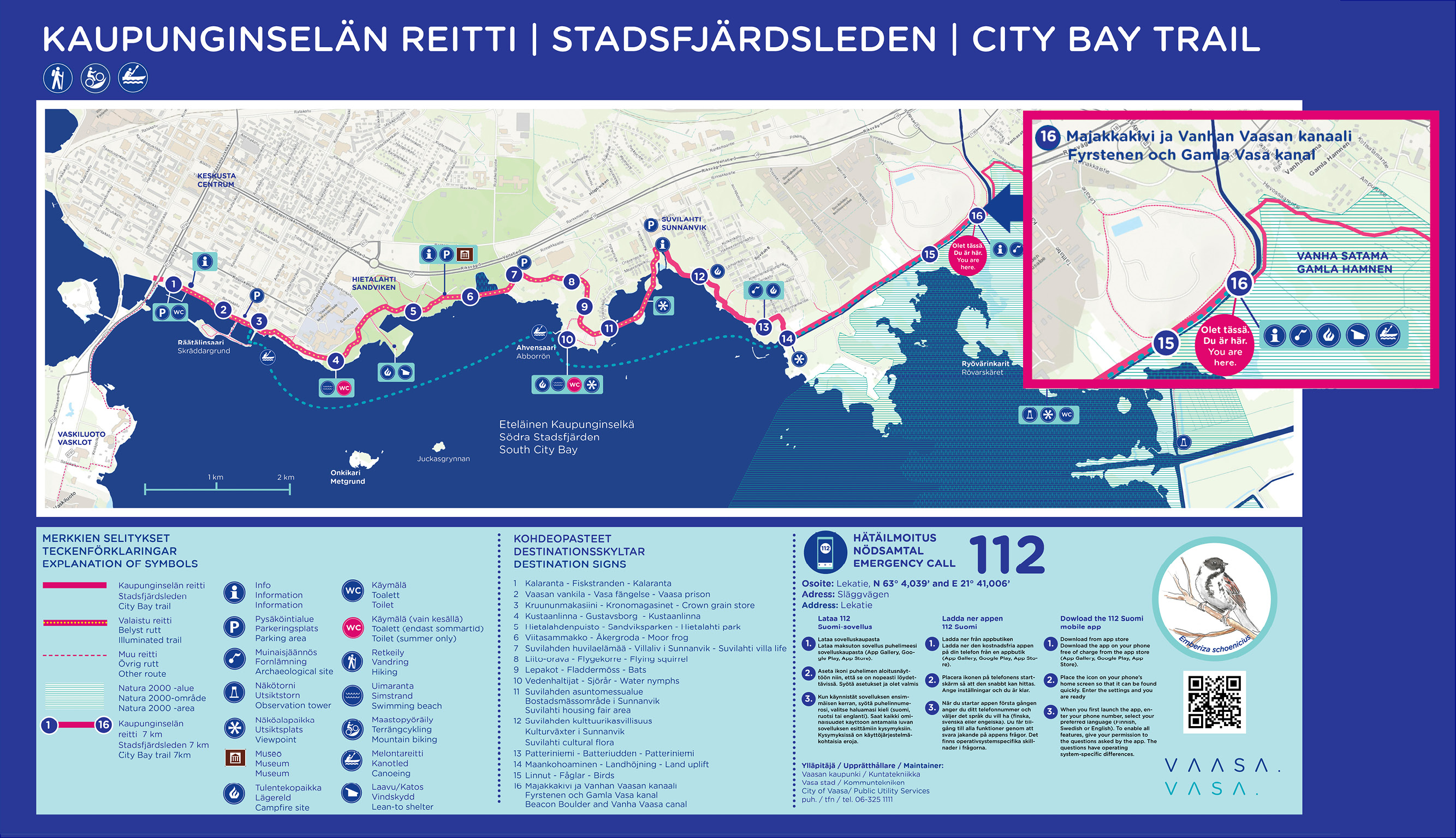
Map of Björkö-Panike hiking trails.
https://www.nationalparks.fi/description-of-trails#BjorkoPanikeHikingArchipelago
-
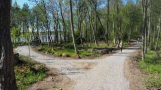
The first part of the nature trail around Vaasa Southern City Bay (Eteläinen kaupunginselkä – Södra Stadsfjärden) is now complete (opening 1.6.2022). The ten kilometer long trail runs along the shores of Vaasa from Kalaranta all the way to Risö, and along the trail, new rest areas and a completely new bridge over the Old Vaasa canal have been built.
Facts about the route
- Kalaranta-Risö is the beginning of an approximately 30 kilometers long outdoor trail around the City Bay.
- Along the trail, rest areas, benches and landing places for paddlers have been built. In addition, the lighting and signs have been improved.
- On the trail there are several culturally and historically valuable objects, which signs erected along the trail tell more about.
- The trail is mostly accessible and, for example, from Suvilahti there is a two-meter-wide accessible passage all the way to Majakkakivi.
-
About 45 kilometres long hiking route through the Nature reserve Levaneva. Starting from Rajavuoren Wild Life and Hiking Centre in Laihia.
-
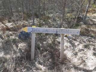
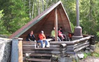
Goljatlelden is about 18 km long and marked in the terrain with signs and yellow markings. Goljatleden starts at the corner of the biathlon arena at Vargberget’s leisure center. The trail goes from Vargberget to the forest around Svartbäck and there you also find rest cabins.
Coordinates ETRS-TM35FIN N: 6942607 E: 215212
-
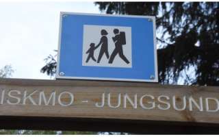
The trail goes through the scenic area around the lakes in Iskmo and Jungsund and starts at Jungsund sports field, Jungsund road 641. You can choose distances from 1.8 km up to 12 km. Picnic areas with the possibility of grilling, you will find at Strömssund (2 km from the start), at Kråknässkatan (3 km from start) and at Björnhällorna (6.5 km from the start). You can also start your hike from Hallonnäs, Tistronskärsvägen 98.
You find printed maps of the trail at the starting places and also as PDF-files from this page. -
Kuni hiking trail consists of two routes: the north trail (6,4 km) and the south trail (7,9 km). The total lenght of the trail is 12,5 km and it starts at Kunintie 100 (next to the information board).
https://korsholm.fi/valfard/fritidsverksamhet/naturstigar-och-friluftsleder/kunileden
-
Start Point: Åbergintie 64.
Length: 11 km circular route.
Difficulty: Challenging.
Walking Time: 2.5-3 hours.
The Orisberg area has a diverse history, influenced by many key figures in Finnish history, from Zacharias Topelius to Jean Sibelius. The atmosphere around Orisberg Church is charming, and the starting point for the route is the bell tower, where, according to the tale, Sibelius and Aino Järnfelt got engaged. The route winds around Kotilampi through varied terrain on trails, duckboards, and forest roads. Those planning a shorter excursion can follow the hiking trail to Kotilampi cabin and return along the same path to the church. Those taking on the longer route continue from the cabin, circumnavigating the entirety of Kotilampi.
https://isokyro.fi/vapaa-aika-ja-matkailu/liikunta/luontoreitit/patikkareitisto/
-

Variable and beautiful nature, swamp, old forest and the mythical Björnberget, paths partly made by people and animals under a period of 100 – 200 years and a ribbon of small lakes and rest areas – that`s how to describe Petsmo Vandringsled.
You can walk a distance from 0,6 km up to 12,5 km, depending how you choose your route. The walking trail has two start places and if you choose to walk the whole trail you get to experience all four campfire places, all of them unique in their own way, but all with fantastic views.
Read more about the walking trail here
info@petsmovandringsled.fi
-
The Pilvilampi recreational area is located approximately nine kilometers east of the city centre. It makes up a proportion of an elongated ridge, of which includes Höstvesi and continues north of Vaasa. The recreational area itself covers an area of roughly 800 hectares. In the winter, the area is ridden with marked cross-country ski trails, which in summer are transformed into bicycle and hiking paths.
Download brochure for the nature path at Pilvilampi here.
https://www.vaasa.fi/en/living/freetime/naturevaasa/attractions/natural-environments/pilvilampi/
-
In the area, there are hiking trails and lean-tos, as well as an approximately 8-meter high observation tower with stunning views. Firewood is delivered to the lean-tos a few times a year. During the winter, there are also unlit ski trails in the area. The Rajavuori hiking trail is approximately 5.5 km long, forming a circular route. The trail starts from the wilderness and hiking center.
From Rajavuori, there is a connection to Levälampi, a recreational area maintained by Metsähallitus on the border of Kurikka and Laihia. Levälampi is also connected to Jurva’s Pässilä and further to Kalajaisjärvi in Ilmajoki. The route is known as the “Kurjenkierros,” and the journey from Rajavuori to Kalajaisjärvi covers a distance of 30 km.”
https://laihia.fi/hyvinvointi-ja-vapaa-aika/liikunta/liikuntatilat-ja-alueet/ulkoliikuntapaikat/
-
Signs from Norrvalla, Vöråvägen 305-307.
Routes from 3 km to 7 km.The connecting route between Bobergsleden and Vitmossleden provides the opportunity for long trips as the distance is over 20 km round trip. Shorter stages can also be hiked along the trail as it passes several slip roads along the forest road in Rökiö where you can start.
You experience varied nature in the form of boulders, old magic forest, bogs and swamps as well as ancient relics.Karta Norrvalla-Boberget
Karta Norrvalla-Boberget-Lasor-Vitmossenhttps://www.vora.fi/tjanster/motion-och-idrott/vandringsleder/
-
In the coming years, Vähäkyrö will create, based on the hiking trail development plan 2021, five hiking trail networks:
- Hiking trail network from Kruutari to Mestoosplassi
- Ojaniemi-Hyyriä trail network
- Saarenpää-Mullolan Polkureitti Trail
- Korkiavuoren Luontopolut Nature Trails
- Petulian Patikka Trail
- Map application (in Finish)
In addition, four thematic trails are under development:
- Viiden Sillan Polkureitti Kyrönjoen Varrella (transl. Five bridges along the Kyrönjoki riverbanks Trail) (published in the trail app, to be further developed in 2023)
- Vähäkyrö Children’s Hiking Trail (to be linked to the Ojaniemi-Hyyriä trail)
- Kolkin Patikkapolku hiking trail (this area is listed as a built cultural heritage site of national significance)
- Kirkkosaaren Historiapolku history-themed trail (Kirkkosaari and Kirkkosaari pond, Kaavontönkkä and Vähäkyrö church precinct that are also a built cultural heritage site of national significance)
-
Västerö Hiking Trails are situated in the outer archipelago of the municipality of Vörå and can be reached by car. The trail starts from the parking areas on Söderskatavägen and Equityvägen, and the visitor can choose trails from 3 km up to 12 km. A map for the area is found in the parking area. There are also maps along the trail.
Along the trails there are a memorial for the Equity (a ship that carried weapons during the civil war in Finland), the cliffs of Ryssberget, the old land uplift forests, bays, flads and seashores.
There are campfire sites and resting spots, dry toilets, two huts to be used as rest spots (they are not meant for overnight stays). NOTE! No wood supply.
https://www.nationalparks.fi/description-of-trails#VasteroHiking
-
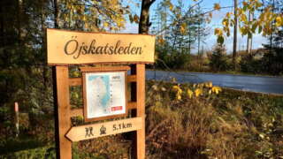
Length: The trail is 5.1 kilometres one way (10.2 km round trip).
Marking: The trail is market with blue dots and arrows in nature.Start: The trail starts from the north end of the village at Tåning (63.2454251, 21.9258751).
Parking is available at the community’s marina at Kalkmagasinet (63.2449409, 21.9296705).Directions: When you arrive, drive along Österhankmovägen and turn right at Österhankmovägen 900, where there are signs for parking and a memorial. Drive 100 meters forward, all the way down to the harbor and park the car there. Walk back to Österhankmovägen and walk another 100 meters along the road you drove. The trail starts on the left side and there is a map and instructions at the starting point.
Service along the trail: rest area with wind protection and at the end of the trail there is a barbecue area with benches.
https://korsholm.fi/valfard/fritidsverksamhet/naturstigar-och-friluftsleder/ojskatsleden