
Activities and Nature
Search for interesting activities by type and / or area or with the help of keywords, end by pressing "Show results"
7 Search results, page 1/1
Clear filters-
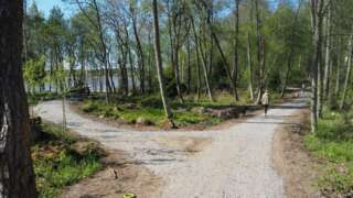
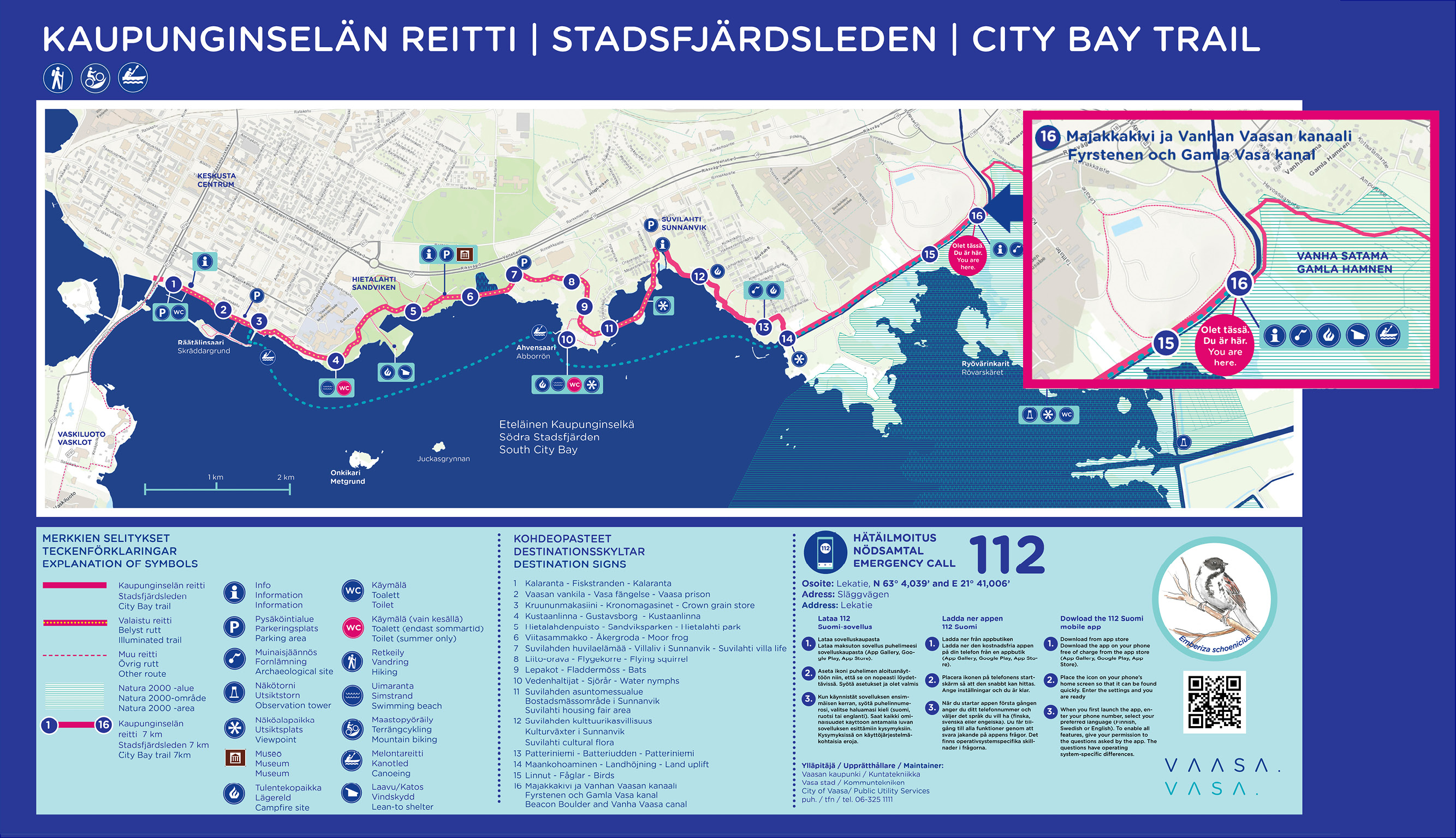
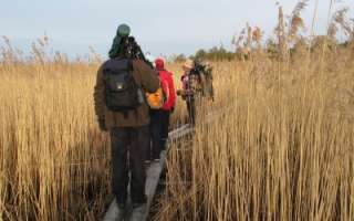
The first part of the nature trail around Vaasa Southern City Bay (Eteläinen kaupunginselkä – Södra Stadsfjärden) is now complete (opening 1.6.2022). The ten kilometer long trail runs along the shores of Vaasa from Kalaranta all the way to Risö, and along the trail, new rest areas and a completely new bridge over the Old Vaasa canal have been built.
Facts about the route
- Kalaranta-Risö is the beginning of an approximately 30 kilometers long outdoor trail around the City Bay.
- Along the trail, rest areas, benches and landing places for paddlers have been built. In addition, the lighting and signs have been improved.
- On the trail there are several culturally and historically valuable objects, which signs erected along the trail tell more about.
- The trail is mostly accessible and, for example, from Suvilahti there is a two-meter-wide accessible passage all the way to Majakkakivi.
-
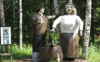
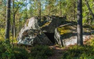
History and culture in the form of Edvin Hevonkoski’s wooden and metal sculptures, in the middle of the nature along the nature trail in Asevelikylä. At the moment there are over 100 named works of art or groups of works of art. The Korsu Museum consists of a crew bunker filled with wartime objects, the maintenance bunker Töpinä and a smoke sauna, all authentic from World War II.
+358 50 560 6496
-
The Pilvilampi recreational area is located approximately nine kilometers east of the city centre. It makes up a proportion of an elongated ridge, of which includes Höstvesi and continues north of Vaasa. The recreational area itself covers an area of roughly 800 hectares. In the winter, the area is ridden with marked cross-country ski trails, which in summer are transformed into bicycle and hiking paths.
Download brochure for the nature path at Pilvilampi here.
https://www.vaasa.fi/en/living/freetime/naturevaasa/attractions/natural-environments/pilvilampi/
-
Risö ja Ryövärinkari 4.9 kilometres
The Eteläinen Kaupunginselkä bay (the Southern City Bay) is located southeast of Vaasa city centre. There’s a nature trail and two bird towers in the area. Follow the signs ´Lintutorni` from the crossroad of the streets: Kanavasillantie/Hevossaarentie. Parking area at the end of road Ampujantie.
Coordinates: Euref-Fin (~ WGS84) lat: 63° 03.7663′ lon: 21° 41.9537’ETRS-TM35FIN N: 7003634 E: 232305
https://www.nationalparks.fi/kvarken/descriptionoftrails#RisoNatureTrail
-
Welcome to a walk from the Öjbergsmossen bog to a giant’s pot hole and over a devil’s field to the dwarfed pinetree-covered meteorite-crater rim of Söderfjärden
Öjberget is located in Sundom, at a 9 km distance from the centre of Vaasa. The trail is 2,5 km long and the starting point is beside a big information board in Öjberget´s stadium area.
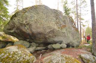
Öjberget is a unique ”mountain landscape” for the Ostrobothnian coast, with its highest point at an elevation of 50 metres. It is a magically rocky landscape with very old dwarfed pine trees, dramatic rocky formations, a giant’s kettle, and an ancient shore area called the Devil’s Field
The most ancient traces of human activity in the area of Vaasa are also found here. The findings originate from the Stone Age about 4,000 years ago.
In the outlook tower(+65 m a.s.l.) on the top of the slalom hill there are info boards about what you see in different directions: the meteorite impact crater Söderfjärden, the Kvarken archipelago, the village of Sundom and the centre of Vaasa.
-
In the coming years, Vähäkyrö will create, based on the hiking trail development plan 2021, five hiking trail networks:
- Hiking trail network from Kruutari to Mestoosplassi
- Ojaniemi-Hyyriä trail network
- Saarenpää-Mullolan Polkureitti Trail
- Korkiavuoren Luontopolut Nature Trails
- Petulian Patikka Trail
- Map application (in Finish)
In addition, four thematic trails are under development:
- Viiden Sillan Polkureitti Kyrönjoen Varrella (transl. Five bridges along the Kyrönjoki riverbanks Trail) (published in the trail app, to be further developed in 2023)
- Vähäkyrö Children’s Hiking Trail (to be linked to the Ojaniemi-Hyyriä trail)
- Kolkin Patikkapolku hiking trail (this area is listed as a built cultural heritage site of national significance)
- Kirkkosaaren Historiapolku history-themed trail (Kirkkosaari and Kirkkosaari pond, Kaavontönkkä and Vähäkyrö church precinct that are also a built cultural heritage site of national significance)
-
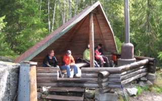
Öjen’s nature trail, situated at the south side of Vaasa, is 4,5 km long. There are information signs along the trail that tell you about the area’s nature, medicinal plants and folk tales. There are also maps showing your location. The trail is easy to walk on because the terrain is fairly flat. However, please remember that the duckboards can be very slippery depending on the weather conditions. It takes about 2,5 to 3 hours to go around the trail.
Facilities: at the campfire site, there are benches, firewood, an axe and a dry toilet.
The nature trail is reached from the parking area along Myrgrundintie road (road number 6741). Walk along the smaller Öjenvägen road about 300 metres until you see a small bridge and information sign on your left side.