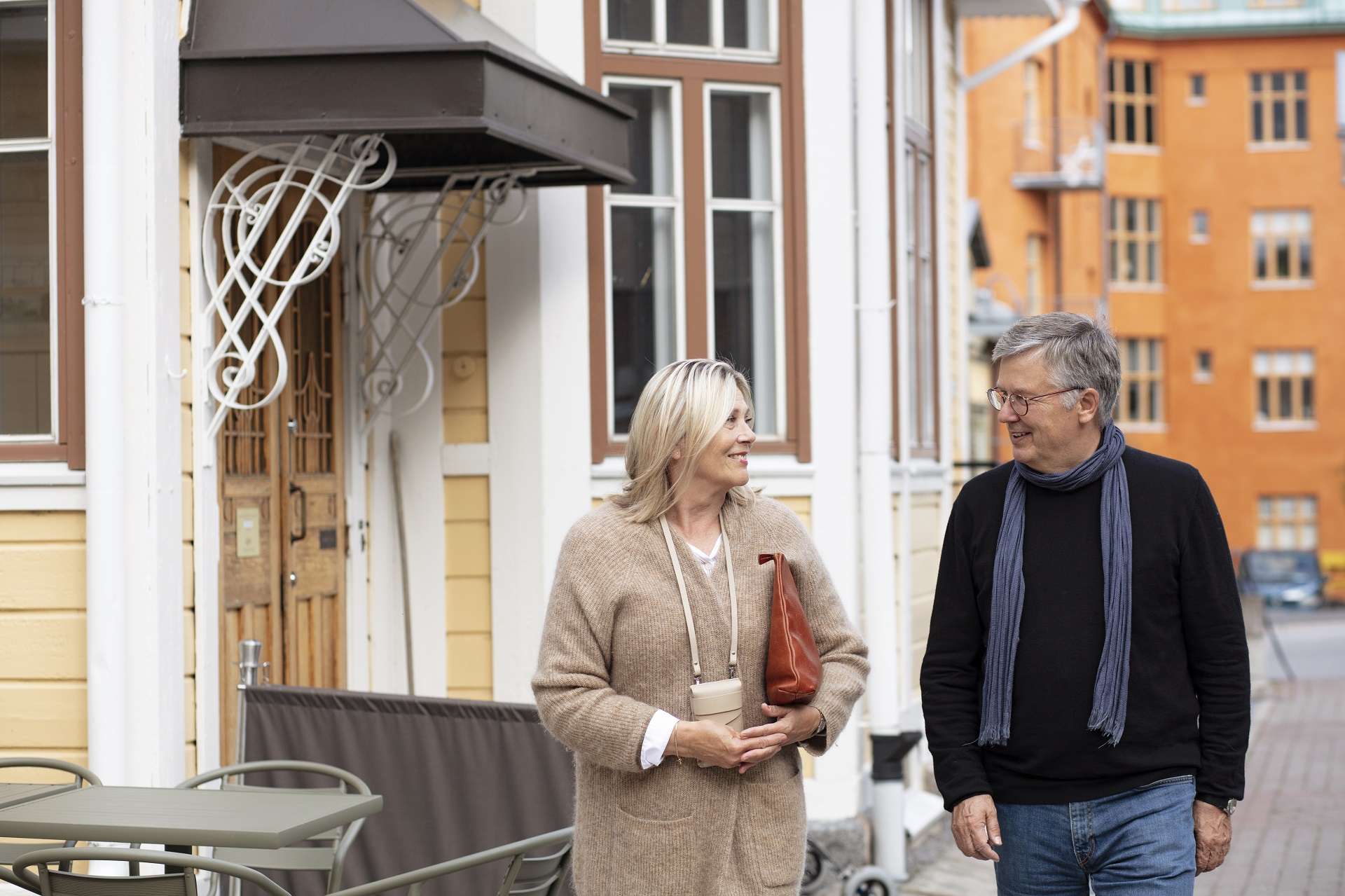
Central Vaasa is filled with fine architectural history and the buildings have many interesting stories to tell. Experience the city on foot in the footsteps of architects from different ages or jump into the world of past cultural influences. Choose a guided walk or go out and discover Vaasa on your own.
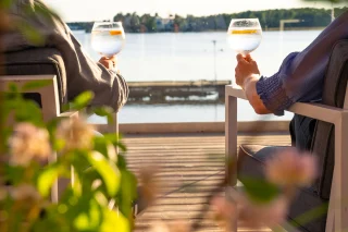
The summer invites you to join unique guided walking tours where the history, culture, and people of the Vaasa region come to life. Whether you’re intrigued by captivating cemetery stories, historic buildings, charming villas, or coastal village scenery – there’s something for everyone in the program.
Guided summer walks
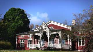
Explore the picturesque Strömsö villa, follow in the footsteps of smugglers on Replot Island, or dive into the dramatic past of Old Vaasa. Each tour offers fresh perspectives and surprising details, even in the most familiar surroundings.
📅 Tours take place from June to August in Vaasa and nearby areas.
🎟 Don’t forget to book your spot at least 12 hours in advance!
Below is a list of the tours available summer 2026
At other times, guided tours can be arranged by appointment, read more about that here.
JUNE 2026
JULY 2026
Thu July 2 Strömsö
Tue July 2 Vasa 420 years
Tue July 7 Strömsö
Thu July7 The Ortodoxa cemetery
Tue July 7 Graveyard Walking tour, Vaasa (free of charge)
Tue July 14 Strömsö
Tue July 14 Graveyard Walking tour, Vaasa (free of charge)
Tue 14.7 Brandgatornas Vasa II
Tue July 21 Strömsö
Tue July 21 Graveyard Walking tour, Vaasa (free of charge)
Tue July 21 Kappelinmäki graveyard
Sat July 25 Strömsö
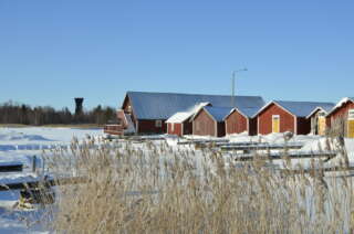
Sat July 25 Replot’s history
Tue July 28 Strömsö
Tue July 28 Evening walk in Palosaari
Thu July 30 Strömsö
Thu July 30 Vasa’s summer flower plantations
Discover the city on your own
-
Explore the History of Old Vaasa on Foot or by Bike
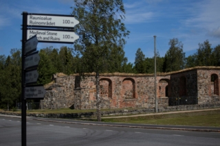
The mobile route guide of Old Vaasa takes you on a journey into the city’s past. Produced by the museums of the City of Vaasa, the guide aims to make the area’s history more widely known and easily accessible.
You can use the mobile guide in a browser on a smart device or in the Citynomadi app, which you can download from your app store. The free app also allows you to use the mobile route guide offline.
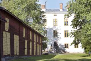
The Old Vaasa mobile route guide introduces you to historical sites from the 18th and 19th centuries, as well as to personal life stories. Along the route, you’ll learn more about the city’s historic buildings and Vaasa’s past role as an important trading hub. From its founding in 1606 until the fire of 1852, the city of Vaasa was located in what is now Old Vaasa. After the fire, the city was relocated to its present location.
You can choose to walk or cycle the route. In the guide, the walking route is marked in yellow. The cycling route is longer and marked in brown. The walking route starts at the Old Vaasa Museum in the Falanderska House and ends at the Old Vaasa Canal, where the city’s western toll gate stood in the 1600s. The cycling route begins at the Old Vaasa Hospital, where the Vaasa County Hospital was founded in the 18th century, and ends near Molnträsket at the Northern Royal Farm and water mills.
https://www.vaasa.fi/sv/aktuellt/mobilruttguiden-vacker-vasas-historia-till-liv/
-
Explore Korsholm Castel in the 1390s through AR
Explore Korsholm Castel, in Old Vaasa, in the 1390s through an Augmented Reality experience. Experience the place, as it is likely to have looked over 600 years ago.
The app takes you on a tour around the castle mound.
- You will be able to see several different scenes by activating the 12 Points of Interest in the app.
- When you get close enough to a marked point the scenes and stories are activated.
Download the app: KORSHOLM AR in Google Play or App Store
-
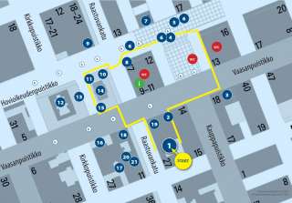
In this guide, you will find a walking route that goes around the market square and City Hall with a lot of interesting things to see and learn on the way. There are also walking guides with longer routes available.
We hope that this walking guide will help you to discover the rich variety of nature, culture and history that are in our immediate environment.
-
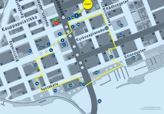
In this guide, you will find a walking route that goes northwards from the City Hall and back along the shore with a lot of interesting things to see and learn on the way. There are also walking guides with other routes available.
We hope that this walking guide will help you to discover the rich variety of nature, culture and history that are in our immediate environment.
-
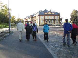
If you go for a walk with the members of the walking club, you will get to know Vaasa and its inhabitants better at the same time! For 20 years, the club’s members have walked 10 km every Sunday. The Sunday walks always start from the market square (by the statue) at 10 am. and go in different directions around Vaasa, the pace is set by the participants and no one is left alone.
Organizer Vaasan Kävelyklubi ry, but you do not need to be a member of the club to participate in these hikes, all hiking enthusiasts are welcome.
Also note the Vaasan Marssi walking event in your calendar! The event, which is held annually in August, offers a chance to meet new people and see fantastic nature.
+358 407361238
helena.kyrolainen@netikka.fi
Nature trails in Vaasa
-
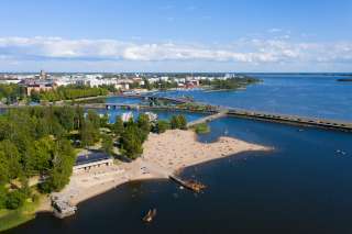
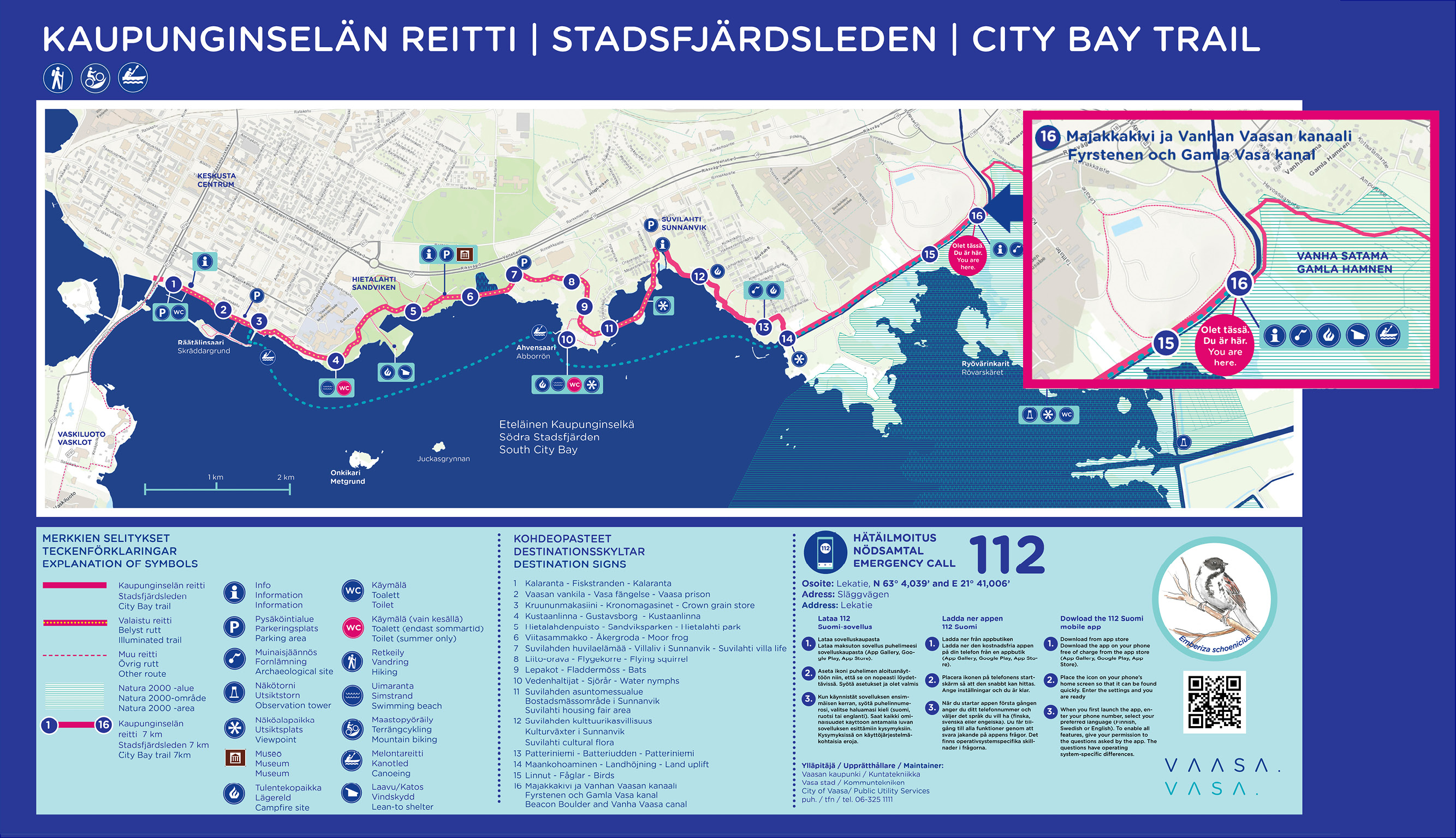
The first part of the nature trail around Vaasa Southern City Bay (Eteläinen kaupunginselkä – Södra Stadsfjärden) is now complete (opening 1.6.2022). The ten kilometer long trail runs along the shores of Vaasa from Kalaranta all the way to Risö, and along the trail, new rest areas and a completely new bridge over the Old Vaasa canal have been built.
Facts about the route
- Kalaranta-Risö is the beginning of an approximately 30 kilometers long outdoor trail around the City Bay.
- Along the trail, rest areas, benches and landing places for paddlers have been built. In addition, the lighting and signs have been improved.
- On the trail there are several culturally and historically valuable objects, which signs erected along the trail tell more about.
- The trail is mostly accessible and, for example, from Suvilahti there is a two-meter-wide accessible passage all the way to Majakkakivi.
-
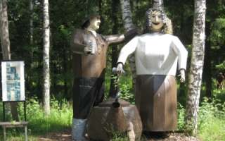
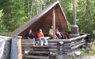
History and culture in the form of Edvin Hevonkoski’s wooden and metal sculptures, in the middle of the nature along the nature trail in Asevelikylä. At the moment there are over 100 named works of art or groups of works of art. The Korsu Museum consists of a crew bunker filled with wartime objects, the maintenance bunker Töpinä and a smoke sauna, all authentic from World War II.
+358 50 560 6496
-
The Pilvilampi recreational area is located approximately nine kilometers east of the city centre. It makes up a proportion of an elongated ridge, of which includes Höstvesi and continues north of Vaasa. The recreational area itself covers an area of roughly 800 hectares. In the winter, the area is ridden with marked cross-country ski trails, which in summer are transformed into bicycle and hiking paths.
Map over the trails in Pilvilampi area
Download brochure for the nature path at Pilvilampi here.
https://www.vaasa.fi/en/living/freetime/naturevaasa/attractions/natural-environments/pilvilampi/
-
Risö ja Ryövärinkari 4.9 kilometres
The Eteläinen Kaupunginselkä bay (the Southern City Bay) is located southeast of Vaasa city centre. There’s a nature trail and two bird towers in the area. Follow the signs ´Lintutorni` from the crossroad of the streets: Kanavasillantie/Hevossaarentie. Parking area at the end of road Ampujantie.
Coordinates: Euref-Fin (~ WGS84) lat: 63° 03.7663′ lon: 21° 41.9537’ETRS-TM35FIN N: 7003634 E: 232305
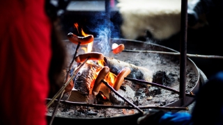
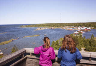
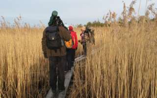
There are great views opening out from the Ryövärinkari birdwatching tower to the Eteläinen Kaupunginselkä bay (the southern city bay) and excellent opportunities to observe the birds in the area. There is another lower birdwatching platform by the mouth of River Tuovilanjoki. At the time of the spring and autumn migrations, hundreds of geese, swans, waders and thousands of waterfowls use the area as a resting and feeding place. There is a campfire site and a dry toilet near the birdwatching tower. Please note that there is no firewood maintenance at the campfire site. The trail is not maintained in the winter.
-
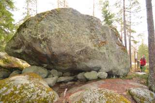
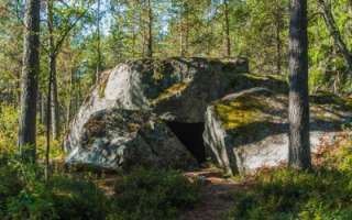
Welcome to a walk from the Öjbergsmossen bog to a giant’s pot hole and over a devil’s field to the dwarfed pinetree-covered meteorite-crater rim of Söderfjärden
Öjberget is located in Sundom, at a 9 km distance from the centre of Vaasa. The trail is 2,5 km long and the starting point is beside a big information board in Öjberget´s stadium area.
Öjberget is a unique ”mountain landscape” for the Ostrobothnian coast, with its highest point at an elevation of 50 metres. It is a magically rocky landscape with very old dwarfed pine trees, dramatic rocky formations, a giant’s kettle, and an ancient shore area called the Devil’s Field
The most ancient traces of human activity in the area of Vaasa are also found here. The findings originate from the Stone Age about 4,000 years ago.
In the outlook tower(+65 m a.s.l.) on the top of the slalom hill there are info boards about what you see in different directions: the meteorite impact crater Söderfjärden, the Kvarken archipelago, the village of Sundom and the centre of Vaasa.
-
Öjen’s nature trail, situated at the south side of Vaasa, is 4,5 km long. There are information signs along the trail that tell you about the area’s nature, medicinal plants and folk tales. There are also maps showing your location. The trail is easy to walk on because the terrain is fairly flat. However, please remember that the duckboards can be very slippery depending on the weather conditions. It takes about 2,5 to 3 hours to go around the trail.
Facilities: at the campfire site, there are benches, firewood, an axe and a dry toilet.
The nature trail is reached from the parking area along Myrgrundintie road (road number 6741). Walk along the smaller Öjenvägen road about 300 metres until you see a small bridge and information sign on your left side.
https://www.luontoon.fi/en/trails/ojen-nature-trail-vaasa-34912-en
-
Vaasa’s Outdoor Recreation Trails on the Map
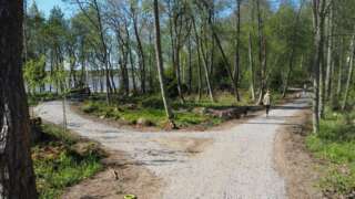
The nature trails in Vaasa have been combined into a cohesive network of about 70 kilometers, which was inaugurated in September 2025.
The work to unify the nature trails in Vaasa began in 2022, and over the course of three years the trails have been improved, standardized signs have been installed in the terrain, and a modern digital map of the network has been created.
The network’s trails run across land owned by the city in various districts. Along the trails there are campfire sites, beaches, playgrounds, outdoor exercise areas, and other places to experience. The trails are marked with signposts and information boards as well as on a digital map.
-
Desitnations and trails in the service Luontoon
You can find information on all outdoor recreation destinations, trails and services throughout Finland on the Luontoon service.